Frégate Island
- Frégate Island
-
Île Frégate (Maurice)
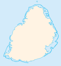
Aussi appelé Frégate Island en anglais, l'île Frégate est une île au sud-ouest de Rodrigues, une dépendance de la République de Maurice dans l'océan Indien. Doublée d'un îlot plus au sud, elle se trouve à l'intérieur du lagon non loin des côtes sur lesquelles sont installées l'aéroport de Plaine Corail.
 Portail du monde maritime
 Portail des Mascareignes
Catégories : Île de Maurice | Île de l'océan Indien | Géographie de Rodrigues
Wikimedia Foundation.
2010.
Contenu soumis à la licence CC-BY-SA. Source : Article Frégate Island de Wikipédia en français (auteurs)
Regardez d'autres dictionnaires:
Frégate Island — or sometimes Frigate Island is the easternmost (55 km east of Mahé) of the granitic Inner Islands of the Seychelles. It is only 2.19 km² and is primarily known as a secluded, private luxury resort and its Anse Victorin beach was voted The World s … Wikipedia
Ile Fregate (Maurice) — Île Frégate (Maurice) Pour les articles homonymes, voir Île Frégate. Île Frégate Frégate Island (en) Géographie Pays … Wikipédia en Français
Île Frégate (Maurice) — Pour les articles homonymes, voir Île Frégate. Île Frégate Frégate Island (en) Géographie Pays … Wikipédia en Français
Denis Island — The entrance to the grounds of the Denis Island Resort, as viewed from the airstrip. Denis Island is the second northeasternmost Island in the Seychelles. It is 60 miles north of Mahé and lies at the northern edge of the Seychelles bank, along… … Wikipedia
Aride Island — is the northernmost granitic island in the Seychelles and is 10km north of Praslin. It is 68 hectares in area and is a nature reserve. Aride is leased and managed by the Island Conservation Society of Seychelles. The only human inhabitants are… … Wikipedia
Bainbridge Island — Île de Bainbridge Bainbridge Island (en) Géographie Pays … Wikipédia en Français
Cerf Island — (1.27 km2) lies 4 km off the north coast of Mahé in the Seychelles. Cerf Island measures more than 1.5 kilometres (0.93 mi) long and almost 1 kilometre (0.62 mi) wide, it reaches a height of 108 metres (354 ft). The… … Wikipedia
Classe Whidbey Island — L USS Germantown arrive à Seattle … Wikipédia en Français
Cousine Island — Vorlage:Infobox Insel/Wartung/Höhe fehlt Cousine Island Cousine Island Gewässer Indischer Ozean … Deutsch Wikipedia
Lampedusa Island — Lampedusa Pour les articles homonymes, voir Lampedusa (homonymie). 35°30′N 12°36′E / … Wikipédia en Français
 Maurice
 Maurice
