Epping (Essex)
- Epping (Essex)
-
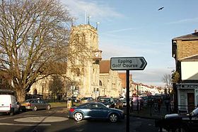
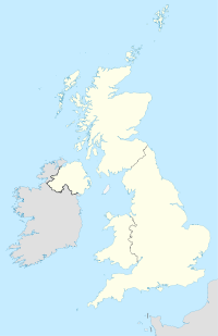
Epping est une ville de l'est de l'Angleterre, dans le comté d'Essex. Elle possède une population estimée à 11 047 habitants (2001).
Jumelage
Wikimedia Foundation.
2010.
Contenu soumis à la licence CC-BY-SA. Source : Article Epping (Essex) de Wikipédia en français (auteurs)
Regardez d'autres dictionnaires:
Epping, Essex — Epping (Essex) Pour les articles homonymes, voir Epping (homonymie). Epping: Grande Rue avec église du 19. siecle Saint John the Baptist Epping est une vil … Wikipédia en Français
Epping (Essex) — 51.7002777777780.11305555555555 Koordinaten: 51° 42′ N, 0° 7′ O … Deutsch Wikipedia
Epping (New South Wales) — Epping Beecroft Road vom Bahnhof aus Staat … Deutsch Wikipedia
Epping — bezeichnet: Epping (London Underground), eine Station der London Underground Epping bezeichnet folgende Städte und Gemeinden: Epping (Altenmarkt an der Alz), Ortsteil der Gemeinde Altenmarkt an der Alz, Landkreis Traunstein, Bayern Epping… … Deutsch Wikipedia
Epping — infobox UK place country = England official name= Epping latitude= 51.7004 longitude= 0.1087 population = 11,047 [http://www.eppingforestdc.gov.uk/Council Services/planning/census/Epping.asp Parish Profile : Epping ] ] shire district= Epping… … Wikipedia
Essex bus route H1 — Essex County Council route H1 is a supported bus route in Essex on the outskirts of London, United Kingdom, serving as a useful connection between Loughton, Debden, Epping, North Weald and Harlow in south west Essex. The service is currently… … Wikipedia
Epping Forest (District) — Epping Forest District Lage in Essex Status District Region East of England Verw.grafschaft Essex … Deutsch Wikipedia
Epping Forest (district) — Epping Forest is a local government district of the county of Essex, England. It is named for Epping Forest, of which the district contains a large part. It lies to the north of Greater London, but is not part of it.ettlementThe north east of the … Wikipedia
Essex bus route 541 — is a bus route in Essex which started on the 29th April 2007. It is operated by Arriva Shires Essex out of Harlow garage under contract to Essex County Council. It serves local communities of Buckhurst Hill, Loughton, Abridge, Theydon Bois and… … Wikipedia
Essex bus route 55 — is a bus route in south west Essex on the outskirts of north east London, United Kingdom operated by Travel with Hunny (TWH) based in Rainham. The route is in competition with Imperial Buses H1. Both routes are basically the same except from a… … Wikipedia

 Angleterre
