Ebnat-kappel
- Ebnat-kappel
-
Ebnat-Kappel
| Ebnat-Kappel |
| Une vue d'ensemble de la commune serait la bienvenue |
| Administration |
| Pays |
Suisse |
 |
| Canton |
Saint-Gall |
| District |
Toggenburg |
| Langue |
Allemand |
| N° OFS |
3352 |
| Code postal |
9642 |
| Site web |
www.ebnat-kappel.ch |
| Géographie |
| Superficie |
43,57 km² |
| Altitude |
630 |
| Coordonnées |
47° 16′ 00″ N 9° 07′ 00″ E / 47.266663, 9.11666847° 16′ 00″ N 9° 07′ 00″ E / 47.266663, 9.116668 |
Communes limitrophes
(voir carte) |
Nesslau-Krummenau, Hemberg, Wattwil, Gommiswald, Rieden , Kaltbrunn, Schänis, Amden |
| Localité(s) |
Brandholz, Wintersberg, Bendel |
| Démographie |
| Population |
4 877 (1er janvier 2007[1]) |
| Densité |
111,93 hab./km² |
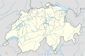
| Localisation |
Localisation de Ebnat-Kappel en Suisse. |
modifier  |
Ebnat-Kappel est une commune suisse du canton de Saint-Gall, située dans le district de Toggenburg.
Références
Sur les autres projets Wikimedia :
 Portail de la Suisse
Catégorie : Commune du canton de Saint-Gall
Wikimedia Foundation.
2010.
Contenu soumis à la licence CC-BY-SA. Source : Article Ebnat-kappel de Wikipédia en français (auteurs)
Regardez d'autres dictionnaires:
Ebnat-Kappel — Basisdaten Staat: Schweiz Kanton … Deutsch Wikipedia
Ebnat-Kappel — Saltar a navegación, búsqueda Ebnat Kappel Escudo … Wikipedia Español
Ebnat-Kappel — Une vue d ensemble de la commune serait la bienvenue Administration Pays Suisse Canton Saint Gall … Wikipédia en Français
Ebnat-Kappel — Infobox Swiss town subject name = Ebnat Kappel municipality name = Ebnat Kappel municipality type = municipality imagepath coa = |pixel coa= languages = German canton = St. Gallen iso code region = CH SG district = Toggenburg lat d=47|lat… … Wikipedia
Ebnat-Kappel — Original name in latin Ebnat Kappel Name in other language Ebnat, Ebnat Kappel State code CH Continent/City Europe/Zurich longitude 47.26195 latitude 9.12473 altitude 644 Population 4852 Date 2013 04 02 … Cities with a population over 1000 database
Bahnstrecke Ebnat-Kappel–Wil — Toggenburgerbahn Streckenlänge: 24.86 km Spurweite: 1435 mm (Normalspur) Stromsystem: 15 kV 16.7 Hz Maximale Neigung: 15 ‰ Wil–Ebnat Kappel Legende … Deutsch Wikipedia
Bahnstrecke Wil–Ebnat-Kappel — Toggenburgerbahn Streckenlänge: 24.86 km Spurweite: 1435 mm (Normalspur) Stromsystem: 15 kV 16.7 Hz Maximale Neigung: 15 ‰ Wil–Ebnat Kappel Legende … Deutsch Wikipedia
Ebnat SG — Ebnat Kappel Basisdaten Kanton: St. Gallen Wahlkreis: Wahlkreis Toggenburg … Deutsch Wikipedia
Kappel (Toggenburg) — Ebnat Kappel Basisdaten Kanton: St. Gallen Wahlkreis: Wahlkreis Toggenburg … Deutsch Wikipedia
Kappel SG — Ebnat Kappel Basisdaten Kanton: St. Gallen Wahlkreis: Wahlkreis Toggenburg … Deutsch Wikipedia
 Ebnat-Kappel