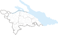
- Communes du canton de Thurgovie
-
Cet article présente une liste des communes du canton de Thurgovie.
En 2011, le canton de Thurgovie compte 80 communes, réparties en 5 districts[1].
Le canton s'étend également sur une partie du lac de Constance, sans que cette zone ne fasse partie d'aucune commune[1] ; La superficie cantonale incluant cette part de lac, celle-ci est comprise dans la liste ci-dessous.
Sommaire
Liste
La liste des 80 communes du canton de Thurgovie:
Commune No OFS District Superficie
[km²][2]Population
(décembre 2009)[3]Densité
[hab./km²] Aadorf
4551 Münchwilen 19,93 7 980 400,4  Affeltrangen
4711 Weinfelden 14,42 2 288 158,7  Altnau
4641 Kreuzlingen 6,68 1 981 296,6  Amlikon-Bissegg
4881 Weinfelden 14,43 1 298 90  Amriswil
4461 Arbon 19,02 11 894 625,3  Arbon
Arbon4401 Arbon 5,94 13 430 2 260,9  Basadingen-Schlattingen
4536 Frauenfeld 15,64 1 699 108,6  Berg
Berg4891 Weinfelden 13,09 3 050 233  Berlingen
4801 Frauenfeld 3,56 839 235,7  Bettwiesen
4716 Münchwilen 3,85 1 054 273,8  Bichelsee-Balterswil
4721 Münchwilen 12,27 2 575 209,9  Birwinken
4901 Weinfelden 12,35 1 296 104,9  Bischofszell
4471 Weinfelden 11,62 5 536 476,4  Bottighofen
4643 Kreuzlingen 2,39 2 079 869,9  Braunau
4723 Münchwilen 9,17 677 73,8  Bürglen
4911 Weinfelden 11,68 3 213 275,1  Bussnang
4921 Weinfelden 18,91 2 079 109,9  Diessenhofen
4545 Frauenfeld 10,12 3 314 327,5  Dozwil
4406 Arbon 1,32 608 460,6  Egnach
4411 Arbon 18,42 4 277 232,2  Erlen
Erlen4476 Weinfelden 12,19 3 135 257,2  Ermatingen
4646 Kreuzlingen 10,44 2 877 275,6  Eschenz
4806 Frauenfeld 12,01 1 655 137,8  Eschlikon
4724 Münchwilen 6,21 3 808 613,2  Felben-Wellhausen
4561 Frauenfeld 7,38 2 394 324,4  Fischingen
4726 Münchwilen 30,62 2 562 83,7  Frauenfeld
4566 Frauenfeld 27,37 22 878 835,9  Gachnang
4571 Frauenfeld 9,72 3 423 352,2  Gottlieben
4651 Kreuzlingen 0,33 309 936,4  Güttingen
4656 Kreuzlingen 9,49 1 429 150,6  Hauptwil-Gottshaus
4486 Weinfelden 12,49 1 789 143,2  Hefenhofen
4416 Arbon 6,05 1 154 190,7  Herdern
4811 Frauenfeld 13,67 981 71,8  Hohentannen
4495 Weinfelden 8 593 74,1  Homburg
4816 Frauenfeld 24,15 1 463 60,6  Horn
Horn4421 Arbon 1,72 2 584 1 502,3  Hüttlingen
4590 Frauenfeld 11,6 829 71,5  Hüttwilen
4821 Frauenfeld 17,66 1 450 82,1  Kemmental
4666 Kreuzlingen 25,02 2 229 89,1  Kesswil
4426 Arbon 4,47 981 219,5  Kradolf-Schönenberg
4501 Weinfelden 10,96 3 307 301,7 Kreuzlingen
4671 Kreuzlingen 11,49 18 933 1 647,8  Langrickenbach
4681 Kreuzlingen 10,85 1 108 102,1  Lengwil
4683 Kreuzlingen 8,89 1 367 153,8  Lommis
4741 Münchwilen 8,6 1 086 126,3  Mammern
4826 Frauenfeld 5,42 584 107,7  Märstetten
4941 Weinfelden 9,97 2 454 246,1  Matzingen
4591 Frauenfeld 7,71 2 530 328,1  Müllheim
4831 Frauenfeld 8,73 2 629 301,1  Münchwilen
4746 Münchwilen 7,79 4 760 611  Münsterlingen
4691 Kreuzlingen 5,42 2 768 510,7  Neunforn
4601 Frauenfeld 11,36 986 86,8  Pfyn
Pfyn4841 Frauenfeld 13,18 1 933 146,7  Raperswilen
4846 Kreuzlingen 7,67 402 52,4  Rickenbach
4751 Münchwilen 1,56 2 510 1 609  Roggwil (TG)
4431 Arbon 12,04 2 872 238,5  Romanshorn
4436 Arbon 8,75 9 606 1 097,8  Salenstein
4851 Kreuzlingen 6,54 1 256 192  Salmsach
4441 Arbon 2,7 1 296 480  Schönholzerswilen
4756 Weinfelden 10,94 770 70,4  Sirnach
4761 Münchwilen 12,41 6 929 558,3  Sommeri
4446 Arbon 4,21 518 123  Schlatt
4546 Frauenfeld 15,53 1 601 103,1  Sommeri
4446 Arbon 4,21 518 123  Steckborn
4864 Frauenfeld 8,76 3 461 395,1  Stettfurt
4606 Frauenfeld 6,36 1 099 172,8  Sulgen
4506 Weinfelden 9,13 3 420 374,6  Tägerwilen
4696 Kreuzlingen 11,52 3 763 326,6  Thundorf
4611 Frauenfeld 15,61 1 296 83  Tobel-Tägerschen
4776 Münchwilen 7,11 1 380 194,1  Uesslingen-Buch
4616 Frauenfeld 14,01 1 052 75,1  Uttwil
4451 Arbon 4,34 1 711 394,2  Wagenhausen
4871 Frauenfeld 11,84 1 603 135,4  Wäldi
Wäldi4701 Kreuzlingen 12,23 998 81,6  Wängi
Wängi4781 Münchwilen 16,43 4 067 247,5  Warth-Weiningen
4621 Frauenfeld 8,2 1 202 146,6  Weinfelden
4946 Weinfelden 15,5 10 141 654,3  Wigoltingen
4951 Weinfelden 17,15 2 123 123,8  Wilen
Wilen4786 Münchwilen 2,27 2 056 905,7  Wuppenau
4791 Weinfelden 12,15 1 021 84  Zihlschlacht-Sitterdorf
4511 Weinfelden 12,2 2 042 167,4 Partie du lac de Constance 9329 128,09 0 0  Thurgovie. Total : 80
991,02 244 330 246,5 La commune de Horn est enclavée entre le canton de Saint-Gall et le lac de Constance.
Notes et références
- [xls] Liste officielle des communes de la Suisse - 01.01.2008 sur Office fédéral de la statistique. Consulté le 15 décembre 2008
- Statistique de la superficie 2004/09 : Données communales sur Office fédéral de la Statistique. Consulté le 23 septembre 2010
- Bilan de la population résidante permanente (total) selon les districts et les communes, en 2009 sur Office fédéral de la Statistique. Consulté le 1er septembre 2010
Annexes
Liens internes
Liens externes
Wikimedia Foundation. 2010.

