Carterton (Oxfordshire)
- Carterton (Oxfordshire)
-
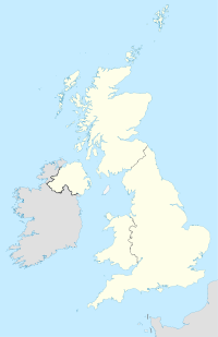
Carterton est une ville dans l'Oxfordshire, en Angleterre. Elle se trouve à 24 kilometres d'Oxford.
Wikimedia Foundation.
2010.
Contenu soumis à la licence CC-BY-SA. Source : Article Carterton (Oxfordshire) de Wikipédia en français (auteurs)
Regardez d'autres dictionnaires:
Carterton, Oxfordshire — Carterton (Oxfordshire) Carterton … Wikipédia en Français
Carterton, Oxfordshire — Infobox UK place official name= Carterton country= England region= South East England population= 18000 (Parish) os grid reference= SP2806 london distance= 72.4mi latitude= 51.756 longitude= 1.587 post town= postcode area= postcode district= dial … Wikipedia
Carterton — may refer to:* Carterton, Oxfordshire, England * Carterton, New Zealand … Wikipedia
Carterton — bezeichnet zwei Orte: Carterton (Oxfordshire) in England Carterton (Neuseeland) in Neuseeland Diese Seite ist eine Begriffsklärung zur Unterscheidung mehrerer mit demselben Wort bezeichneter Begriffe … Deutsch Wikipedia
Carterton F.C. — Football club infobox clubname = Carterton fullname = Carterton Football Club nickname = founded = 1918 ground = Kilkenny Lane, Carterton capacity = chairman = Robert King manager = Gary Brown league = Hellenic Football League Premier Division… … Wikipedia
Oxfordshire — Coat of arms of Oxfordshire Flag of Oxfordshire Motto of … Wikipedia
Oxfordshire County Council elections — Oxfordshire County Council is elected every four years. Contents 1 Political control 2 Council elections 3 By election results 3.1 1997 2001 … Wikipedia
Oxfordshire (UK Parliament constituency) — Oxfordshire Former County constituency for the House of Commons County Oxfordshire 1290 (1290)–1885 … Wikipedia
Oxfordshire — Geografie Status: Zeremonielle und Verwaltungsgrafschaft Region: South East England Fläche: 2.605 km² … Deutsch Wikipedia
Oxfordshire Blue Plaques Board — The plaque commemorating Thomas and Martha Combe in Jericho, Oxford. The Oxfordshire Blue Plaques Board, established in 1999, is administered by the Oxford Civic Society. It oversees the installation of blue plaques on historic buildings in the… … Wikipedia
 Angleterre
