Burgeo
- Burgeo
-
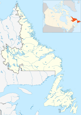
Burgeo est une ville canadienne située sur la côte sud de Terre-Neuve. La ville est située à l'extrémité de la route 480, qui est sa seule attache terrestre. Burgeo est le point de départ de nombreux bateaux côtiers assurant la desserte des communautés isolées de la côte sud, comme Ramea et Gray River. C'est aussi le point de départ d'un express en direction de Rose Blanche-Harbour La Cou et Port-aux-Basques.
Ses premiers habitants ont été les Français, arrivés au début des années 1700. Ils furent très vite remplacés par les Anglais, qui à leur tour devinrent Canadiens.
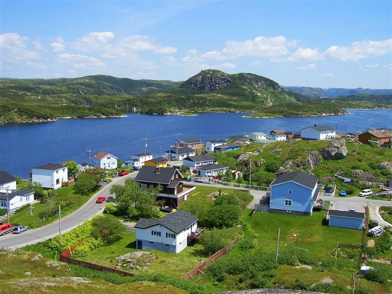
Aujourd'hui, la ville compte environ 1 600[1] habitants. Elle possède de nombreux attraits touristiques, ainsi qu'un hôpital.
Références
Lien externe
Wikimedia Foundation.
2010.
Contenu soumis à la licence CC-BY-SA. Source : Article Burgeo de Wikipédia en français (auteurs)
Regardez d'autres dictionnaires:
Burgeo — Burgeo, Insel im Lorenzgolf, südöstlich von Neufundland (Britisch Nordamerika) … Pierer's Universal-Lexikon
Burgeo — Original name in latin Burgeo Name in other language State code CA Continent/City America/St Johns longitude 47.61668 latitude 57.61516 altitude 1 Population 1627 Date 2008 04 11 … Cities with a population over 1000 database
Burgeo-LaPoile — Infobox Canadian provincial riding name = Burgeo LaPoile province = Newfoundland and Labrador legislature = Newfoundland and Labrador House of Assembly member type = MHA party colour = Liberal member = Kelvin Parsons member party = Liberal census … Wikipedia
Burgeo, Newfoundland and Labrador — Infobox Settlement official name = Burgeo other name = native name = nickname = settlement type = Town motto = imagesize = image caption = flag size = image seal size = image shield = shield size = city logo = citylogo size = pushpin pushpin… … Wikipedia
Burin—Burgeo — Infobox Canada electoral district province = Newfoundland and Labrador caption = fed status = defunct fed created = 1949 fed abolished = 1976 fed election first = 1949 fed election last = 1974Burin Burgeo was a federal electoral district in… … Wikipedia
Burin—Burgeo — fut une circonscription électorale fédérale de Terre Neuve, représentée de 1949 à 1979. La circonscription de Burin Burgeo apparue lorsque Terre Neuve joignit la Confédération canadienne en 1949. Abolie en 1976, elle fut fusionnée à Humber Saint… … Wikipédia en Français
Upper Burgeo, Newfoundland and Labrador — Upper Burgeo is a settlement in the La Poile District. It is located west of Burgeo. The population as of 2001 is 1,782.ee also*List of communities in Newfoundland and Labrador … Wikipedia
Back Cove, Burgeo, Newfoundland and Labrador — Back Cove is a hamlet in the Burgeo and La Poile District.ee also*List of communities in Newfoundland and Labrador … Wikipedia
Ramea — Administration Pays Canada Province … Wikipédia en Français
List of communities in Newfoundland and Labrador — This page lists communities of the province of Newfoundland and Labrador, Canada. Incorporated towns or cities are recognized as census subdivisions by Statistics Canada and can be found on List of cities and towns in Newfoundland and Labrador.… … Wikipedia

 Canada
 Terre-Neuve-et-Labrador