- Conception Bay South
-
Conception Bay South 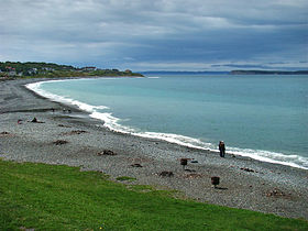
Plage de TopsailAdministration Pays  Canada
Province  Terre-Neuve-et-Labrador
Région Région métropolitaine de Saint-Jean Site Web http://www.conceptionbaysouth.ca/ Démographie Population 21 966 hab. (2006) Densité 370,6 hab./km2 Géographie Coordonnées
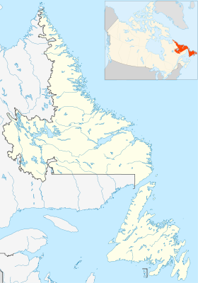
géographiquesSuperficie 59,27 km2 Fuseau horaire UTC-3:30 Géolocalisation sur la carte : Terre-Neuve-et-Labrador

modifier 
Conception Bay South est une ville de Terre-Neuve-et-Labrador, au Canada.
Elle est située sur la rive sud de la baie de la Conception dans la péninsule d'Avalon sur l'île de Terre-Neuve. Elle est à 20 km environ au sud-ouest de Saint-Jean de Terre-Neuve. Elle fait partie de la région métropolitaine de Saint-Jean et la plupart des résidents sont employés à Saint-Jean ou Mount Pearl.
La ville fut formée en 1973 par la fusion de neuf communautés : Chamberlains, Foxtrap, Kelligrews, Lawrence Pond, Long Pond, Manuels, Seal Cove, Topsail et Upper Gullies.
La population en 2006 était de 21 966 habitants, ce qui en fait la troisième ville de la province[1].
Références
Lien externe
Catégories :- Ville de Terre-Neuve-et-Labrador
- Terre-Neuve


Wikimedia Foundation. 2010.