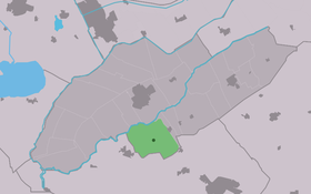
Blesdijke
Contenu soumis à la licence CC-BY-SA. Source : Article Blesdijke de Wikipédia en français (auteurs)
Regardez d'autres dictionnaires:
Weststellingwerf — Infobox Settlement official name = Weststellingwerf mapsize = 280px subdivision type = Country subdivision name = Netherlands subdivision type1 = Province subdivision name1 = Friesland area footnotes = (2006) area total km2 = 228.36 area land km2 … Wikipedia
List of places in the Netherlands — This is an alphabetical list of places (cities, towns, villages) in the Netherlands. Lists per province can be found at:* List of towns in Groningen * List of towns in Friesland * List of towns in Drente * List of towns in Overijssel * List of… … Wikipedia
Weststellingwerf — Gemeinde Weststellingwerf Flagge Wappen Provinz Friesland Bürgermeister … Deutsch Wikipedia
Wolvega — Gemeinde Weststellingwerf Flagge Wappen Provinz … Deutsch Wikipedia
Boijl — 52°54′35″N 6°11′58″E / 52.90972, 6.19944 … Wikipédia en Français
De Blesse — 52°50′38″N 6°2′25″E / 52.84389, 6.04028 … Wikipédia en Français
De Hoeve — 52°53′13″N 6°5′15″E / 52.88694, 6.0875 … Wikipédia en Français
Langelille — 52°50′33″N 5°50′30″E / 52.8425, 5.84167 … Wikipédia en Français
Liste des localités des Pays-Bas par code postal — Cette page est une liste des localités (villes, villages) des Pays Bas par code postal. Les localités ne possédant pas leur propre code postal ne figurent pas dans cette liste. Sommaire 1 1000 1999 1.1 1000 1099 1.2 1100 1199 … Wikipédia en Français
Munnekeburen — 52°50′55″N 5°53′9″E / 52.84861, 5.88583 … Wikipédia en Français
 Pays-Bas