Šalgočka
- Šalgočka
-
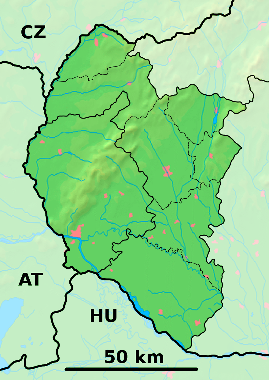
Šalgočka est un village de Slovaquie situé dans la région de Trnava.
Histoire
Première mention écrite du village en 1248.
Notes et références
Catégories : - Village de Slovaquie
- Village et ville du district de Galanta
Wikimedia Foundation.
2010.
Contenu soumis à la licence CC-BY-SA. Source : Article Šalgočka de Wikipédia en français (auteurs)
Regardez d'autres dictionnaires:
Šalgočka — is a village and municipality in Galanta District of the Trnava Region of south west Slovakia.HistoryIn historical records the village was first mentioned in 1248.GeographyThe municipality lies at an elevation of 150 metres and covers an area of… … Wikipedia
Galanta District — District Country Slovakia … Wikipedia
Trnava Region — Geobox | Region name = Trnava category = Region image caption = image caption = symbol = symbol type = etymology = official name = motto = nickname = country = Slovakia country state = region = district = commune = municipality = border = part… … Wikipedia
Dolná Streda — Coordinates: 48°16′11″N 17°45′15″E / 48.26972°N 17.75417°E / 48.26972; 17.75417 … Wikipedia
List of municipalities and towns in Slovakia — Slovakia This is a comprehensive list of municipalities and towns in Slovakia. For lists of towns and municipalities sorted by Regions see the individual articles on Regions. For an outdated list of towns only in Slovakia see also List of towns… … Wikipedia
Zemianske Sady — Location of Galanta District in the Trnava Region Zemianske Sady (old form: Nemeškert; Hungarian: Nemeskürt) is a village and municipality in Galanta District of the Trnava Region of south west Slovakia … Wikipedia
Sládkovičovo — For the Romanian village of Tuta, called Diószeg in Hungarian, see Târgu Trotuş. Coordinates: 48°12′19″N 17°38′39″E / 48.20528°N 17.64417°E … Wikipedia
Čierna Voda — Location of Galanta District in the Trnava Region Čierna Voda (Hungarian: Feketenyék) is a village and municipality in Galanta District of the Trnava Region of south west Slovakia. History … Wikipedia
Čierny Brod — Location of Galanta District in the Trnava Region Čierny Brod (Hungarian: Vízkelet) is a village and municipality in Galanta District of the Trnava Region of south west Slovakia. History … Wikipedia
Dolné Saliby — Location of Galanta District in the Trnava Region Dolné Saliby (Hungarian: Alsószeli) is a village and municipality in Galanta District of the Trnava Region of south west Slovakia. History … Wikipedia
 Slovaquie
 Šalgočka