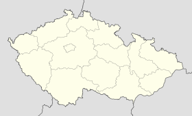
Číhošť
Contenu soumis à la licence CC-BY-SA. Source : Article Číhošť de Wikipédia en français (auteurs)
Regardez d'autres dictionnaires:
Číhošť — Municipality … Wikipedia
Wunder in Čihošť — Josef Toufar (* 14. Juli 1902 in Arnolec; † 25. Februar 1950 in Prag) war ein tschechischer katholischer Priester und Opfer der kommunistischen Verfolgung der katholischen Kirche in der Tschechoslowakei. Toufar war ein gelernter Tischler und… … Deutsch Wikipedia
Toufar — Josef Toufar (* 14. Juli 1902 in Arnolec; † 25. Februar 1950 in Prag) war ein tschechischer katholischer Priester und Opfer der kommunistischen Verfolgung der katholischen Kirche in der Tschechoslowakei. Toufar war ein gelernter Tischler und… … Deutsch Wikipedia
Josef Toufar — (* 14. Juli 1902 in Arnolec; † 25. Februar 1950 in Prag) war ein tschechischer katholischer Priester und Opfer der kommunistischen Verfolgung der katholischen Kirche in der Tschechoslowakei. Toufar war ein gelernter Tischler und wurde erst mit 38 … Deutsch Wikipedia
Joshua Tree National Park — Joshua Tree Nationalpark Joshua Tree Nationalpark … Deutsch Wikipedia
District de Havlíčkův Brod — 49° 36′ 47″ N 15° 34′ 52″ E / 49.61315, 15.58101 … Wikipédia en Français
RPGFan — articleissue onesource = April 2008 notability = April 2008Infobox Website name = RPGFan url = http://www.rpgfan.com type = Gaming (RPGs) owner = Cerberus Media Group author = Mickey Shannon launch date = 1997 (as Lunarnet)RPGFan is a website… … Wikipedia
Geographical centre of Europe — The location of the geographical centre of Europe depends on the definition of the borders of Europe, mainly whether remote islands are included to define the extreme points of Europe, and on the method of calculating the final result. Thus,… … Wikipedia
Havlíčkův Brod — Coordinates: 49°36′21″N 15°34′43″E / 49.60583°N 15.57861°E / 49.60583; 15.57861 … Wikipedia
Havlíčkův Brod District — Coordinates: 49°36′47″N 15°34′52″E / 49.613157°N 15.581017°E / 49.613157; 15.581017 … Wikipedia
 République tchèque
