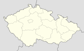
Čečkovice
Contenu soumis à la licence CC-BY-SA. Source : Article Čečkovice de Wikipédia en français (auteurs)
Regardez d'autres dictionnaires:
District de Havlíčkův Brod — 49° 36′ 47″ N 15° 34′ 52″ E / 49.61315, 15.58101 … Wikipédia en Français
Havlíčkův Brod — Coordinates: 49°36′21″N 15°34′43″E / 49.60583°N 15.57861°E / 49.60583; 15.57861 … Wikipedia
Havlíčkův Brod District — Coordinates: 49°36′47″N 15°34′52″E / 49.613157°N 15.581017°E / 49.613157; 15.581017 … Wikipedia
Bor (Tachov District) — See other meanings of Bor. Geobox | Settlement name = Bor other name = category = Town image caption = symbol = Bor (CZE) coat of arms.png etymology = official name = motto = nickname = country = Czech Republic country state = region = Plzeň… … Wikipedia
List of German exonyms for places in the Czech Republic — Below are links to subpages with more detailed listings of the German language names of towns and villages in different regions of the Czech Republic. Many of these German names are now exonyms, but used to be endonyms commonly used by the local… … Wikipedia
Chotěboř — Coordinates: 49°43′15″N 15°40′13″E / 49.72083°N 15.67028°E / 49.72083; 15.67028 … Wikipedia
Okrouhlička — (until 1945 Šejdorf, German: Scheibelsdorf) is a small village in the Havlíčkův Brod District, Vysočina Region of the Czech Republic. 199 people live there and it has 6,84 km². Okrouhlička was first documented in 1307 … Wikipedia
Bačkov (Tschechien) — Bačkov … Deutsch Wikipedia
Bonkov — Boňkov … Deutsch Wikipedia
Bor u Tachova — Bor … Deutsch Wikipedia
 République tchèque
