Vollenborn

Vollenborn
Vollenborn
Blason de Vollenborn
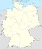
Germany location map.svg
Vollenborn
Administration
Toponyme officiel Vollenborn
Pays Drapeau d'Allemagne Allemagne
Land Thuringe
Arrondissement
(Landkreis)
Arrondissement d'Eichsfeld
Code communal
(Gemeindeschlüssel)
16 0 61 099
Code postal 37 355
Indicatif téléphonique 036 076
Immatriculation EIC
Site web www.eichsfelder-kessel.de
Politique
Bourgmestre
(')
Klaus Glasebach
Partis au pouvoir
Géographie
Coordonnées 51° 30′ 41″ N 10° 21′ 45″ E / 51.511319, 10.36252151° 30′ 41″ Nord
       10° 21′ 45″ Est
/ 51.511319, 10.362521
  
Altitude (NN) 385 m
Superficie 2,41 km2
Démographie
Population 242 hab. (31 décembre 2010)
Densité 100 hab./km2

Vollenborn est une commune allemande située dans l'arrondissement d'Eichsfeld en Thuringe.

Sommaire

Géographie

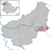
Situation de Vollenborn dans l'arrondissement

La commune fait partie de la Communauté d'administration d'Eichsfeld-Kessel.

Histoire

Démographie

Évolution démographique
1910 1933 1939 1995 2000 2005 2010
354[1] 321[2] 377[2] 319 277 268 242[3]

Notes et références

Sur les autres projets Wikimedia :


Wikimedia Foundation. 2010.

Contenu soumis à la licence CC-BY-SA. Source : Article Vollenborn de Wikipédia en français (auteurs)

Игры ⚽ Поможем написать реферат

Regardez d'autres dictionnaires:

  • Vollenborn — Wappen Deutschlandkarte …   Deutsch Wikipedia

  • Vollenborn — Infobox Ort in Deutschland image photo = Wappen = Wappen Vollenborn.png lat deg = 51 |lat min = 21 |lat sec = 44 lon deg = 10 |lon min = 30 |lon sec = 40 Lageplan = Bundesland = Thüringen Landkreis = Eichsfeld Verwaltungsgemeinschaft =… …   Wikipedia

  • Vollenborn — Original name in latin Vollenborn Name in other language Vollenborn State code DE Continent/City Europe/Berlin longitude 51.35 latitude 10.5 altitude 509 Population 280 Date 2011 04 25 …   Cities with a population over 1000 database

  • Фолленборн — Коммуна Фолленборн Vollenborn Герб …   Википедия

  • Asbach/Sickenberg — Wappen Deutschlandkarte …   Deutsch Wikipedia

  • Bebendorf — Wappen Deutschlandkarte …   Deutsch Wikipedia

  • Beinrode — Wappen Deutschlandkarte …   Deutsch Wikipedia

  • Bernterode (bei Worbis) — Wappen Deutschlandkarte …   Deutsch Wikipedia

  • Bodenrode — Wappen Deutschlandkarte …   Deutsch Wikipedia

  • Brehme (Eichsfeld) — Wappen Deutschlandkarte …   Deutsch Wikipedia

Share the article and excerpts

Direct link
Do a right-click on the link above
and select “Copy Link”