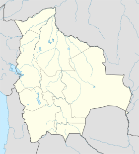
Tolata
Contenu soumis à la licence CC-BY-SA. Source : Article Tolata de Wikipédia en français (auteurs)
Regardez d'autres dictionnaires:
Tolata — Basisdaten Einwohner (Stand) 2953 Einw. (Fortschreibung 2010) [1] Rang Rang 142 Höhe 2.711� … Deutsch Wikipedia
Tolata (Municipio) — Municipio Tolata Basisdaten Einwohner (Stand) Bevölkerungsdichte 7341 Einw. (Fortschreibung 2010)[1] 99 Einw./km² Telefonvorwahl (+591) Fläche 74 … Deutsch Wikipedia
Trusts of Land and Appointment of Trustees Act 1996 — The Trusts of Land and Appointment of Trustees Act (TOLATA) 1996 is an Act of Parliament of the United Kingdom, which altered the law in relation to trusts of land in England, Wales, Scotland and Northern Ireland.BackgroundTOLATA came into force… … Wikipedia
Liste der Verwaltungseinheiten von Bolivien — Der südamerikanische Binnenstaat Bolivien gliedert sich in: 9 Departamentos 112 Provinzen (Provincias) 337 Landkreise (Municipios) 1374 Kantone (Cantones) Inhaltsverzeichnis 1 Departamento Beni … Deutsch Wikipedia
Liste des divisions administratives de la Bolivie — La Bolivie comporte sept niveaux de divisions administratives : L État bolivien; les départements, deuxièmes niveaux, au nombre de 9; Les provinces (provincia en espagnol), troisièmes niveaux, au nombre de 112; Les municipalités (municipio… … Wikipédia en Français
Cochabamba Department — For other uses, see Cochabamba (disambiguation). Department of Cochabamba Quchapampa suyu Flag … Wikipedia
Cochabamba — This article is about Cochabamba (City). For other uses, see Cochabamba (disambiguation). Coordinates: 17°23′S 66°10′W / 17.383°S 66.167°W / 17.383; 66 … Wikipedia
Chapare Province — Villa Tunari on Chapare River Location of Chapare Province within Bolivia … Wikipedia
Mizque Province — Location of Mizque Province within Bolivia General Data Country … Wikipedia
Narciso Campero Province — Location of Narciso Campero Province within Bolivia General Data Country … Wikipedia
 Bolivie
 Cochabamba
