Spennymoor
- Spennymoor
-
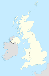
Spennymoor est une ville localisée dans le Compté de Durham, en Angleterre. Elle s'étend de la Wear à approximativement 11 kilomètres du sud de Durham. La ville a été fondée il y a environ 160 ans. Le canton, incluant les villages de Kirk Merrington, Middlestone Moor, Byers Green et Tudhoe, possède une population d'environ 20 000 habitants.
Historique
Spennymoor a, à l'époque, souffert d'une grande crise économique depuis le déclin de l'industrie du charbon. Anne Wood, créatrice des Télétubbies et de Dans le jardin des rêves est né et a grandi à Spennymoor[1].
Références
Liens externes
Wikimedia Foundation.
2010.
Contenu soumis à la licence CC-BY-SA. Source : Article Spennymoor de Wikipédia en français (auteurs)
Regardez d'autres dictionnaires:
Spennymoor — (spr. ßpénnimūr), Stadt in der engl. Grafschaft Durham, 10 km südlich von Durham, hat eine moderne gotische Kirche, einen Stadtpark, Kohlengruben, Eisenhütten und (1901) 16,665 Einw … Meyers Großes Konversations-Lexikon
Spennymoor — (spr. muhr), Stadt in der engl. Grafsch. Durham, unweit des Wear, (1901) 16.661 E … Kleines Konversations-Lexikon
Spennymoor — infobox UK place country = England official name= Spennymoor latitude= 54.70 longitude= 1.59 population = 17,241 (2001) [http://www.durham.gov.uk/durhamcc/usp.nsf/Lookup/Sedgefield%20Settlement%20Summary%20Sheets%20Numbers/$file/Sedgefield+Settlem… … Wikipedia
Spennymoor — Original name in latin Spennymoor Name in other language Spennymoor State code GB Continent/City Europe/London longitude 54.6988 latitude 1.60229 altitude 111 Population 17655 Date 2011 03 03 … Cities with a population over 1000 database
Spennymoor United F.C. — Football club infobox clubname = Spennymoor United fullname = Spennymoor United Football Club nickname = The Moors, The Tigers, Spenny founded = 1877 ground = The Brewery Field capacity = 6,000 league = n/a pattern la1= blackshoulders|pattern b1 … Wikipedia
Spennymoor Town F.C. — Football club infobox clubname = Spennymoor Town fullname = Spennymoor Town Football Club nickname = The Moors founded = 1931 (as Evenwood Town) ground = Brewery Field, Spennymoor capacity = 6,000 chairman = Alan Courtney manager = Jason Ainsley… … Wikipedia
Spennymoor by-election, 1942 — The Spennymoor by election, 1942 was a parliamentary by election held on 21 July 1942 for the British House of Commons constituency of Spennymoor in County Durham. The seat had become vacant when the Labour Member of Parliament (MP) Joseph Batey… … Wikipedia
Spennymoor (UK Parliament constituency) — UK former constituency infobox Name = Spennymoor Type = County Year = 1918 Abolition = 1950 members = oneSpennymoor was a county constituency centred on the town of Spennymoor in County Durham. It returned one Member of Parliament (MP) to the… … Wikipedia
Mount Pleasant, Spennymoor — Coordinates: 54°42′11″N 1°35′02″W / 54.703°N 1.584°W / 54.703; 1.584 Mount Pleasant is a village in … Wikipedia
Chris Moore (English footballer) — Chris Moore Personal information Full name James Christopher Moore[1] … Wikipedia
 Angleterre
