Romariswandkopf
- Romariswandkopf
-
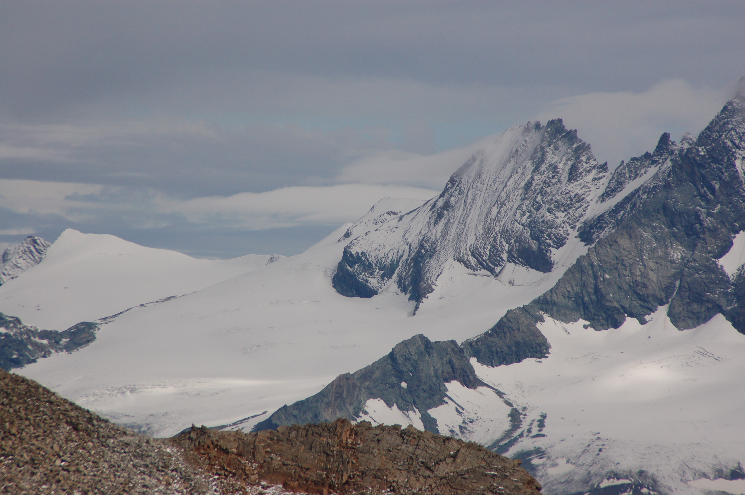
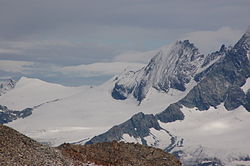
Le Romariswandkopf est une montagne à deux sommets du groupe du Glockner dans le massif du Hohe Tauern en Autriche, à la limite entre le land de Carinthie et le Tyrol oriental. Le sommet principal culmine à 3 508 m d'altitude, le second sommet au nord à 3 491 m. Les deux sommets sont éloignés d'environ 120 mètres.
Catégories :
- Sommet des Alpes autrichiennes
- Montagne du Tyrol
- Montagne de Carinthie
Wikimedia Foundation.
2010.
Contenu soumis à la licence CC-BY-SA. Source : Article Romariswandkopf de Wikipédia en français (auteurs)
Regardez d'autres dictionnaires:
Romariswandkopf — Die Glocknerwand von Süden, links die beiden Romariswandköpfe Höhe … Deutsch Wikipedia
Romariswandkopf — Romariswandkopf, Berg, s. Großglockner … Meyers Großes Konversations-Lexikon
Romariswandköpfe — f1 Romariswandkopf Höhe 3.511 m ü. A. Lage Grenze zwischen Kärnten und Osttirol, Österreich Gebirge … Deutsch Wikipedia
Geography of Austria — Continent Europe Region Central Europe Coordinates … Wikipedia
Geographie Österreichs — Die Lage Österreichs, in der europäischen Union, Europa und der Welt Geographie Österreichs Inhaltsverzeichnis 1 … Deutsch Wikipedia
Glocknerwand — pd1 Glocknerwand links Großglockner, rechts Glocknerwand von Nordwesten Höhe … Deutsch Wikipedia
Schneewinkelkopf — von Westen (Kalser Tauernhaus). Höhe 3.476&# … Deutsch Wikipedia
Teufelskamp — Bild gesucht BWf1 Höhe 3.511 … Deutsch Wikipedia
Hohe Tauern — Carte des Hohe Tauern avec le Grossglockner au centre. Géographie Altitude 3 798 m, Grossglockner … Wikipédia en Français
Großglockner — Großglockner, 3798 m hoher Kulminationspunkt der Glocknergruppe und der Hohen Tauern, liegt an der Grenze von Tirol und Kärnten. Zur Glocknergruppe, die vom Velber Tauern (westlich) bis zum Hochtor (östlich) reicht, gehören außer dem G. folgende… … Meyers Großes Konversations-Lexikon
 Autriche