Mateševo
- Mateševo
-
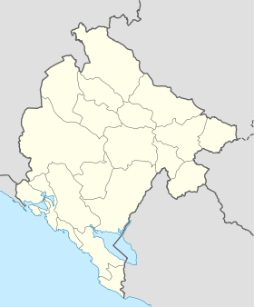
Mateševo (en serbe cyrillique : Матешево) est un village du centre du Monténégro, dans la municipalité de Kolašin.
Démographie
Évolution historique de la population
Évolution démographique
(Source : [1])
| 1948 |
1953 |
1961 |
1971 |
1981 |
1991 |
2003 |
| 260 |
495 |
233 |
219 |
146 |
86 |
97 |
Pyramide des âges (2003)
| Pyramide des âges de la ville de Mateševo |
Pyramide des âges de la ville de Mateševo en 2003 (population totale : 97)[2] :
| Hommes |
Classe d'âge |
Femmes |
|
0
|
? |
1
|
|
0
|
80 et plus |
0
|
|
1
|
75-79 |
5
|
|
2
|
70-74 |
4
|
|
3
|
65-69 |
2
|
|
5
|
60-64 |
4
|
|
2
|
55-59 |
3
|
|
3
|
50-54 |
6
|
|
3
|
45-49 |
2
|
|
3
|
40-44 |
1
|
|
5
|
35-39 |
2
|
|
1
|
30-34 |
3
|
|
1
|
25-29 |
3
|
|
4
|
20-24 |
0
|
|
0
|
15-19 |
5
|
|
6
|
10-14 |
4
|
|
4
|
5-9 |
5
|
|
2
|
0-4 |
2
|
|
Répartition de la population par nationalités (2003)
Source[3]
| Répartition de la population par nationalités |
Nombre |
% |
| Serbes |
56 |
57,73 |
| Monténégrins |
39 |
40,20 |
| Inconnus/Autres |
2 |
2,06 |
Notes et références
- ↑ (sr) Књига 9, Становништво, упоредни преглед броја становника 1948, 1953, 1961, 1971, 1981, 1991, 2003, подаци по насељима, Републички завод за статистику, Подгорица, септембар 2005, COBISS-ID 8764176
- ↑ (sr) Књига 2, Становништво, пол и старост, подаци по насељима, Републички завод за статистику, Подгорица, октобар 2004, COBISS.CG-ID 8489488
- ↑ (sr) Књига 1, Становништво, национална или етничка припадност, подаци по насељима, Републички завод за статистику, Подгорица, септембар 2004, ISBN 86-84433-00-9
Catégories : - Village du Monténégro
- Localité de Kolašin
Wikimedia Foundation.
2010.
Contenu soumis à la licence CC-BY-SA. Source : Article Mateševo de Wikipédia en français (auteurs)
Regardez d'autres dictionnaires:
Mateševo — (Montenegrin Cyrillic: Матешево) is a village in northern Montenegro, within Kolašin municipality. The 2003 census put the population at 97. The first phase of planned Belgrade–Bar motorway will extend from Podgorica to this village. Coordinates … Wikipedia
Autobahn Bar–Boljare — Vorlage:Infobox hochrangige Straße/Wartung/ME A Autoput Bar–Boljare in Montenegro … Deutsch Wikipedia
Bahnstrecke Belgrad–Bar — Streckenlänge: 476 Km km Spurweite: 1435 mm (Normalspur) Zweigleisigkeit: nein … Deutsch Wikipedia
Kolašin — Vue de Kolašin Administration Nom cyrillique Колашин Pays … Wikipédia en Français
Andrijevica — Андријевица Coat of arms … Wikipedia
Vasojevići — The Vasojevići tribe ( sr. Васојевићи) is the biggest Highland clan of Montenegro. It occupies the area between Vjetarnih near Lijeva Rijeka on the South and Bihor under Bijelo Polje on the North, and from Mateševo on the West to Plav on the East … Wikipedia
List of places in Montenegro — This is a list of all census designated places in Montenegro, sorted by municipalities. Places with more than 1000 residents are in italic .Andrijevica*Andrijevica *Andželati *Bojovići *Božići *Cecuni *Đulići *Dulipolje *Gnjili Potok *Gornje Luge … Wikipedia
Konik, Montenegro — Infobox Place official name = Konik area total km2 = 23 population as of = 2005 population total = 34.000 population density km2 = 1478.26 post code = 81000 car plates = PG timezone = UTC+1Konik (Serbian Cyrillic: Коник) is a suburb located in… … Wikipedia
Belgrade–Bar motorway — Infobox European road marker name= Autoput Beograd Bar eroad= length km=0 plalength= 445 km starting terminus=Belgrade junction=ending terminus=Bar countries=Serbia, Montenegro regions= cities=Belgrade, Obrenovac, Požega, Berane, Podgorica,… … Wikipedia
Montenegro — Crna Gora Црна Гора Montenegro … Deutsch Wikipedia
 Monténégro