Lom nad Rimavicou
- Lom nad Rimavicou
-
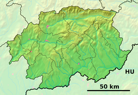
Lom nad Rimavicou est un village de Slovaquie situé dans la région de Banská Bystrica.
Histoire
Première mention écrite du village en 1799.
Notes et références
Catégories :
- Village de Slovaquie
- Village et ville du district de Brezno
Wikimedia Foundation.
2010.
Contenu soumis à la licence CC-BY-SA. Source : Article Lom nad Rimavicou de Wikipédia en français (auteurs)
Regardez d'autres dictionnaires:
Lom nad Rimavicou — Wappen Karte … Deutsch Wikipedia
Lom nad Rimavicou — ( hu. Forgáchfalva) is a village and municipality in Brezno District, in the Banská Bystrica Region of central Slovakia. The approximate latitude is 48.65 and longitude is 19.65 [http://www.fallingrain.com/world/LO/0/Lom nad Rimavicou.html] … Wikipedia
LOM — als Abkürzung steht für: Laminated Object Modelling, ein Rapid Prototyping Verfahren Learning Objects Metadata, einen Standard für Lernsoftware Lebensohrmarke, Marke zur eindeutigen Kennzeichnung von Rindern Lights Out Management, eine… … Deutsch Wikipedia
Závadka nad Hronom — Wappen Karte … Deutsch Wikipedia
Závadka nad Hronom — (Village) Administration Pays Slovaquie … Wikipédia en Français
Liste der Städte und Gemeinden in der Slowakei/H-Ľ — Übersicht H bis Ľ Teil 1 A bis G Teil 2 H bis Ľ Teil 3 M bis R Teil 4 S bis Ž Übersicht H CH I J K L Ľ H Städte und Gemeinden … Deutsch Wikipedia
Liste der Städte und Gemeinden in der Slowakei Teil 2 — Übersicht H bis Ľ Teil 1 A bis G Teil 2 H bis Ľ Teil 3 M bis R Teil 4 S bis Ž Übersicht H CH I J K L Ľ H Städte und Gemeinden … Deutsch Wikipedia
List of municipalities and towns in Slovakia — Slovakia This is a comprehensive list of municipalities and towns in Slovakia. For lists of towns and municipalities sorted by Regions see the individual articles on Regions. For an outdated list of towns only in Slovakia see also List of towns… … Wikipedia
Banská Bystrica Region — Geobox | Region name = Banská Bystrica other name = category = Region image caption = image caption = symbol = symbol type = Coat of arms etymology = official name = motto = nickname = country = Slovakia country state = region = district =… … Wikipedia
Brezno (Okres) — Übersichtskarten Basisdaten Okres/Bezirk Brezno … Deutsch Wikipedia
 Slovaquie


