Lohrheim
- Lohrheim
-
Wikimedia Foundation.
2010.
Contenu soumis à la licence CC-BY-SA. Source : Article Lohrheim de Wikipédia en français (auteurs)
Regardez d'autres dictionnaires:
Löhrheim — Löhrheim, Dorf im nassauischen Amte Dietz; 380 Ew.; kommt schon 790 als Besitzthum Karls des Großen vor … Pierer's Universal-Lexikon
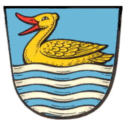
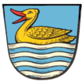
Lohrheim — Wappen Deutschlandkarte … Deutsch Wikipedia
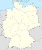
Lohrheim — Infobox Ort in Deutschland Art = Ortsgemeinde Wappen = Wappen Lohrheim.png Wappengröße = lat deg = 50 | lat min = 19 | lat sec = 9 lon deg = 8 | lon min = 2 | lon sec = 57 Lageplan = Bundesland = Rheinland Pfalz Landkreis = Rhein Lahn Kreis… … Wikipedia
Lohrheim — Original name in latin Lohrheim Name in other language State code DE Continent/City Europe/Berlin longitude 50.31667 latitude 8.05 altitude 187 Population 581 Date 2011 04 25 … Cities with a population over 1000 database
Liste der Kulturdenkmäler in Lohrheim — In der Liste der Kulturdenkmäler in Lohrheim sind alle Kulturdenkmäler der rheinland pfälzischen Ortsgemeinde Lohrheim aufgeführt. Grundlage ist die Denkmalliste des Landes Rheinland Pfalz (Stand: 1. Oktober 2010). Einzeldenkmäler Bachstraße 13:… … Deutsch Wikipedia
Oberneisen — Wappen Deutschlandkarte … Deutsch Wikipedia
Aluminiumsilikat — Kaolin, auch als Porzellanerde, Porzellanton, Aluminiumsilikat oder in der Apotheke als Bolus Alba oder Pfeifenerde bezeichnet, ist ein feines, eisenfreies, weißes Gestein, das als Hauptbestandteil Kaolinit, ein Verwitterungsprodukt des Feldspats … Deutsch Wikipedia
Bettendorf (Ems) — Wappen Deutschlandkarte … Deutsch Wikipedia
Bolus alba — Kaolin, auch als Porzellanerde, Porzellanton, Aluminiumsilikat oder in der Apotheke als Bolus Alba oder Pfeifenerde bezeichnet, ist ein feines, eisenfreies, weißes Gestein, das als Hauptbestandteil Kaolinit, ein Verwitterungsprodukt des Feldspats … Deutsch Wikipedia
Bornhofen — Wappen Deutschlandkarte … Deutsch Wikipedia

 Allemagne