Kurimka
- Kurimka
-
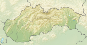
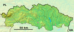
Kurimka est un village de Slovaquie situé dans la région de Prešov.
Histoire
Première mention écrite du village en 1548.
Notes et références
Catégories : - Village de Slovaquie
- Village et ville du district de Svidník
Wikimedia Foundation.
2010.
Contenu soumis à la licence CC-BY-SA. Source : Article Kurimka de Wikipédia en français (auteurs)
Regardez d'autres dictionnaires:
Kurimka — is a village and municipality in Svidník District in the Prešov Region of north eastern Slovakia.HistoryIn historical records the village was first mentioned in 1548.GeographyThe municipality lies at an altitude of 329 metres and covers an area… … Wikipedia
Chudčice — Chudčice … Deutsch Wikipedia
Brněnská přehrada — Staumauer … Deutsch Wikipedia
Prešov Region — Geobox | Region name = Prešov category = Region image caption = image caption = symbol = symbol type = etymology = official name = motto = nickname = country = Slovakia country state = region = district = commune = municipality = border = part… … Wikipedia
Prešov — Geobox | Settlement name = Prešov category = City image caption = City centre of Prešov symbol = etymology = official name = motto = nickname = country = Slovakia country state = region = Prešov district = Prešov municipality = parent = Šariš… … Wikipedia
Dukla — This article is about a town in Poland. For other uses, see Dukla (disambiguation). Dukla Church of the Bernardyni Fathers in Dukla … Wikipedia
Bieszczady Mountains — See also Bieszczady County and Bieszczady National Park. Geobox| Range name = Bukovské vrchy, Bieszczady native name = other name = en. Bukovec Mountains other name1 = en. Bieszczadzkie Mountains image size = image caption = Location in Slovakia… … Wikipedia
Bieszczady National Park — Infobox protected area | name = Bieszczady National Park native name = Bieszczadzki Park Narodowy iucn category = II caption = Tarnica locator x = locator y = location = Subcarpathian Voivodeship, Poland nearest city = lat degrees = lat minutes … Wikipedia
Iwonicz Zdrój — Infobox Settlement name = Iwonicz Zdrój image caption = Mineral water tap room in Iwonicz Zdrój image shield = POL Iwonicz Zdrój COA.svg pushpin pushpin label position = bottom subdivision type = Country subdivision name = POL subdivision type1 … Wikipedia
Svidník District — Infobox Slovak district subject name = Svidník District region district slovak region = Prešov Region population = 33,506 (2001) prefix = ? area = 550 car plate = SK image location = Okres svidnik.png Svidník District ( okres Svidník ) is a… … Wikipedia
 Slovaquie


