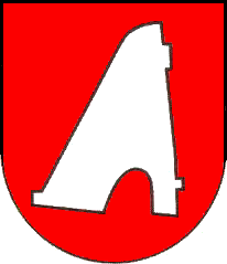
Kapišová
- Kapišová
-
Kapišová est un village de Slovaquie situé dans la région de Prešov.
Histoire
Première mention écrite du village en 1548.
Notes et références
Catégories :
- Village de Slovaquie
- Village et ville du district de Svidník
Wikimedia Foundation.
2010.
Contenu soumis à la licence CC-BY-SA. Source : Article Kapišová de Wikipédia en français (auteurs)
Regardez d'autres dictionnaires:
Kapišová — is a village and municipality in Svidník District in the Prešov Region of north eastern Slovakia.HistoryIn historical records the village was first mentioned in 1548.GeographyThe municipality lies at an altitude of 255 metres and covers an area… … Wikipedia
Prešov Region — Geobox | Region name = Prešov category = Region image caption = image caption = symbol = symbol type = etymology = official name = motto = nickname = country = Slovakia country state = region = district = commune = municipality = border = part… … Wikipedia
Battle of the Dukla Pass — Part of the Eastern Front of World War II Date 8 September – 28 October 1944 Location Dukla Pass, present day Slovakia … Wikipedia
Svidník District — Infobox Slovak district subject name = Svidník District region district slovak region = Prešov Region population = 33,506 (2001) prefix = ? area = 550 car plate = SK image location = Okres svidnik.png Svidník District ( okres Svidník ) is a… … Wikipedia
List of municipalities and towns in Slovakia — Slovakia This is a comprehensive list of municipalities and towns in Slovakia. For lists of towns and municipalities sorted by Regions see the individual articles on Regions. For an outdated list of towns only in Slovakia see also List of towns… … Wikipedia
Cernina — Location of Svidník District in the Prešov Region. Cernina is a village and municipality in Svidník District in the Prešov Region of north eastern Slovakia. History In historical records the … Wikipedia
Mestisko — Location of Svidník District in the Prešov Region. Mestisko is a village and municipality in Svidník District in the Prešov Region of north eastern Slovakia. History In historical records the … Wikipedia
Dobroslava — Location of Svidník District in the Prešov Region. Dobroslava is a village and municipality in Svidník District in the Prešov Region of north eastern Slovakia. Contents … Wikipedia
Medvedie — Location of Svidník District in the Prešov Region. Medvedie is a village and municipality in Svidník District in the Prešov Region of north eastern Slovakia. History In historical records the … Wikipedia
Cigla — Location of Svidník District in the Prešov Region. Cigla is a village and municipality in Svidník District in the Prešov Region of north eastern Slovakia. History In historical records the … Wikipedia
 Slovaquie
 Kapišová