Kuhardt

Kuhardt
Kuhardt
Image illustrative de l'article Kuhardt
Blason de Kuhardt
Germany location map.svg
Kuhardt
Administration
Toponyme officiel Kuhardt
Pays Drapeau d'Allemagne Allemagne
Land Flag of Rhineland-Palatinate.svg Rhénanie-Palatinat
Arrondissement
(Landkreis)
Arrondissement de Germersheim
Code communal
(Gemeindeschlüssel)
07 3 34 015
Code postal 76773
Indicatif téléphonique 07272
Immatriculation GER
Site web http://www.kuhardt.de/
Politique
Bourgmestre
(Ortsbürgermeister)
Roland Eiswirth
Partis au pouvoir
Géographie
Coordonnées 49° 08′ 47″ N 8° 18′ 45″ E / 49.14638, 8.312549° 08′ 47″ Nord
       8° 18′ 45″ Est
/ 49.14638, 8.3125
  
Altitude (NN) 110 m
Superficie 4.88 km2
Démographie
Population 1 914 hab. (31/12/2009)
Densité 392 hab./km2

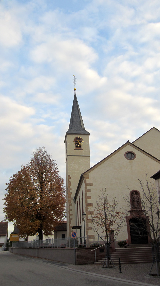
Kuhardt est une municipalité allemande située dans le land de Rhénanie-Palatinat et l'Arrondissement de Germersheim.


Wikimedia Foundation. 2010.

Contenu soumis à la licence CC-BY-SA. Source : Article Kuhardt de Wikipédia en français (auteurs)

Игры ⚽ Поможем написать курсовую

Regardez d'autres dictionnaires:

  • Kuhardt — Wappen Deutschlandkarte …   Deutsch Wikipedia

  • Kuhardt — Infobox Ort in Deutschland Wappen = Kuhardt wappen.gif lat deg = 49 |lat min = 8 |lat sec = 47 lon deg = 8 |lon min = 18 |lon sec = 45 Lageplan = Bundesland = Rheinland Pfalz Landkreis = Germersheim Verbandsgemeinde = Rülzheim Höhe = 110 Fläche …   Wikipedia

  • Kuhardt — Original name in latin Kuhardt Name in other language State code DE Continent/City Europe/Berlin longitude 49.14583 latitude 8.31444 altitude 111 Population 1927 Date 2011 07 31 …   Cities with a population over 1000 database

  • Ringwall Kuhardt — Reste des Walls Burgentyp: Höhenburg …   Deutsch Wikipedia

  • Liste der Kulturdenkmäler in Kuhardt — In der Liste der Kulturdenkmäler in Kuhardt sind alle Kulturdenkmäler der rheinland pfälzischen Ortsgemeinde Kuhardt aufgeführt. Grundlage ist die Denkmalliste des Landes Rheinland Pfalz (Stand: 14. März 2011). Einzeldenkmäler Hördter Straße, auf …   Deutsch Wikipedia

  • Leimersheim — Wappen Deutschlandkarte …   Deutsch Wikipedia

  • Liste der Museen in Rheinland-Pfalz — Inhaltsverzeichnis A B C D E F G H I J K L M N O P Q R S T U V W X Y Z A Alf, Landkreis Cochem Zell Burg Arras …   Deutsch Wikipedia

  • Rilze — Wappen Deutschlandkarte …   Deutsch Wikipedia

  • Rülzheim — Wappen Deutschlandkarte …   Deutsch Wikipedia

  • Кухардт — Коммуна Кухардт Kuhardt Герб …   Википедия

Share the article and excerpts

Direct link
Do a right-click on the link above
and select “Copy Link”