Jatov
- Jatov
-
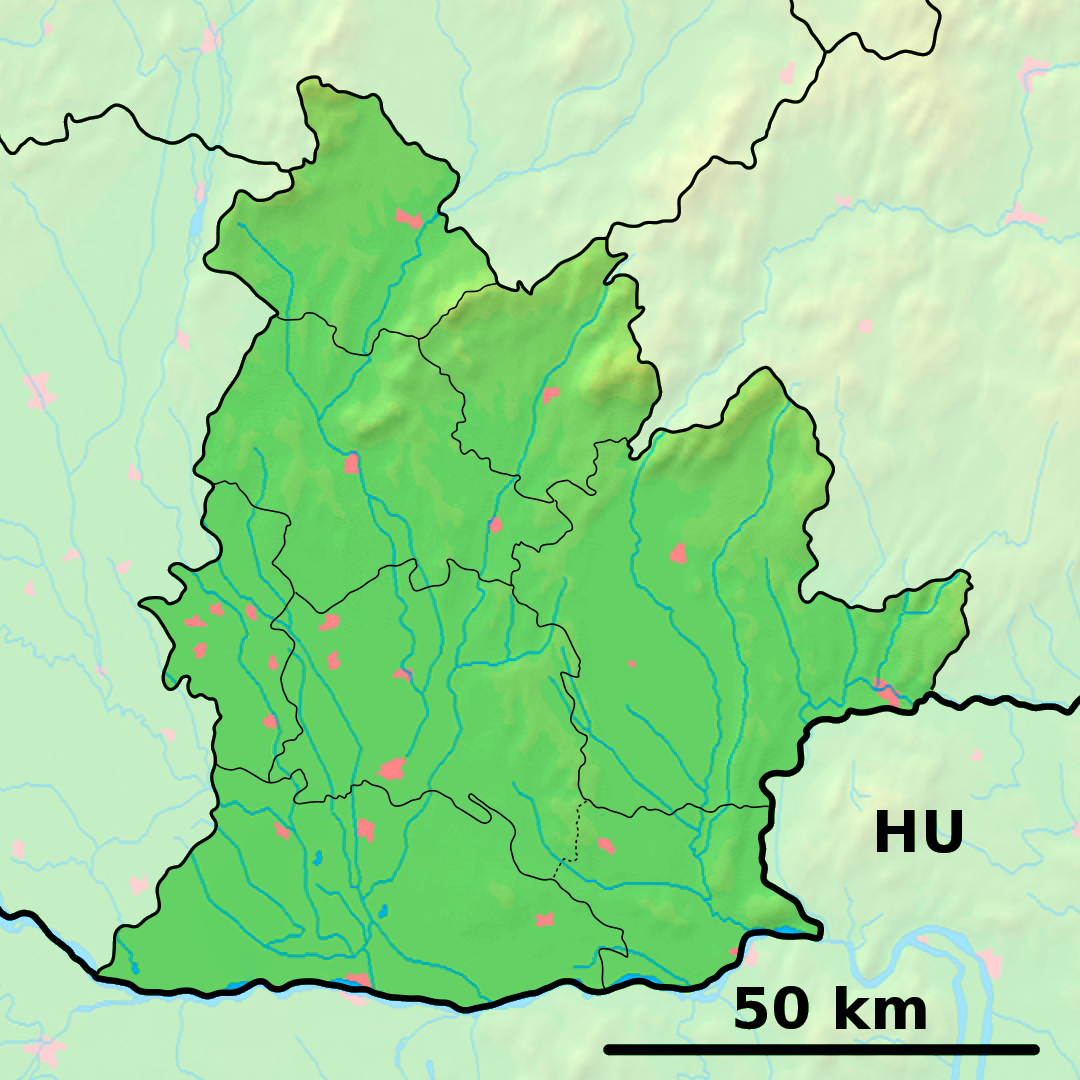
Jatov est un village de Slovaquie situé dans la région de Nitra.
Histoire
Première mention écrite du village en 1952.
Notes et références
Catégories :
- Village de Slovaquie
- Village et ville du district de Nové Zámky
Wikimedia Foundation.
2010.
Contenu soumis à la licence CC-BY-SA. Source : Article Jatov de Wikipédia en français (auteurs)
Regardez d'autres dictionnaires:
Jatov — ( hu. Jattó) is a village and municipality in the Nové Zámky District in the Nitra Region of south west Slovakia.HistoryThe municipality and village is a recent establishment built in 1952.GeographyThe village lies at an altitude of 116 metres… … Wikipedia
District de Nové Zámky — Nové Zámky Informations Pays … Wikipédia en Français
Mail (armour) — Chainmail redirects here. For other uses, see Chainmail (disambiguation). Maille redirects here. For one of several French villages, see Maillé (disambiguation). Maille redirects here. For the French mustard company, see Maille (company). Riveted … Wikipedia
Nové Zámky — Coordinates: 47°59′08″N 18°09′28″E / 47.98556°N 18.15778°E / 47.98556; 18.15778 … Wikipedia
Nitra Region — Coordinates: 48°18′25″N 18°05′11″E / 48.30694°N 18.08639°E / 48.30694; 18.08639 … Wikipedia
Nové Zámky District — District Country Slovakia Region ( … Wikipedia
Šurany — Coordinates: 48°05′14″N 18°11′10″E / 48.08722°N 18.18611°E / 48.08722; 18.18611 … Wikipedia
List of municipalities and towns in Slovakia — Slovakia This is a comprehensive list of municipalities and towns in Slovakia. For lists of towns and municipalities sorted by Regions see the individual articles on Regions. For an outdated list of towns only in Slovakia see also List of towns… … Wikipedia
Dedinka — Nové Zámky District in the Nitra region Dedinka (Hungarian: Fajkürt) is a municipality and village in the Nové Zámky District in the Nitra Region of south west Slovakia. Contents … Wikipedia
Dolný Ohaj — Nové Zámky District in the Nitra region Dolný Ohaj (Hungarian: Ohaj) is a municipality and village in the Nové Zámky District in the Nitra Region of south west Slovakia. Contents … Wikipedia
 Slovaquie
 Jatov
Jatov