Ivanof Bay (Alaska)
- Ivanof Bay (Alaska)
-
55° 54′ 40″ N 159° 29′ 21″ W / 55.911111, -159.489167
Ivanof Bay est une localité d'Alaska (CDP) aux États-Unis dans le Borough de Lake and Peninsula. En 2010, il y avait 7 habitants.
Situation - climat
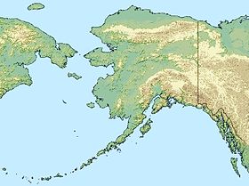
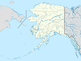
Elle est située à l'extrémité nord-est de la péninsule Kupreanof, à 500 milles (805 km) au sud-ouest d'Anchorage et à 250 milles (402 km) de Dillingham.
Les températures moyennes vont de 21 degrés Fahrenheit (-6 °C) à 50 degrés Fahrenheit (10 °C) en janvier, et de 39 degrés Fahrenheit (4 °C) à 60 degrés Fahrenheit (16 °C) en juillet.
Histoire
Une conserverie de saumon y a été installée entre 1930 et 1950, la poste a été ouverte de 1952 à 1954. Un certain nombre de familles ont émigré depuis Perryville en 1965 dans le but de trouver de meilleures ressources pour la chasse et de fuir les risques d'éruption du Mont Katmai. Mais l'école a tout de même fermé entre 2000 et 2001 faute d'écoliers.
Les actuels habitants pratiquent une économie de subsistance et vivent de chasse et de pêche.
Articles connexes
Sources et références
Wikimedia Foundation.
2010.
Contenu soumis à la licence CC-BY-SA. Source : Article Ivanof Bay (Alaska) de Wikipédia en français (auteurs)
Regardez d'autres dictionnaires:
Ivanof Bay, Alaska — Infobox Settlement official name = Ivanof Bay, Alaska settlement type = CDP nickname = motto = imagesize = image caption = image mapsize = 250px map caption = Location of Ivanof Bay, Alaska mapsize1 = map caption1 = subdivision type = Country… … Wikipedia
Ivanof Bay (Alaska) — Ivanof Bay Lugar designado por el censo de los Estados Unidos … Wikipedia Español
Ivanof Bay — Ivanof Bay, AK U.S. Census Designated Place in Alaska Population (2000): 22 Housing Units (2000): 12 Land area (2000): 3.363382 sq. miles (8.711119 sq. km) Water area (2000): 0.000000 sq. miles (0.000000 sq. km) Total area (2000): 3.363382 sq.… … StarDict's U.S. Gazetteer Places
Ivanof Bay, AK — U.S. Census Designated Place in Alaska Population (2000): 22 Housing Units (2000): 12 Land area (2000): 3.363382 sq. miles (8.711119 sq. km) Water area (2000): 0.000000 sq. miles (0.000000 sq. km) Total area (2000): 3.363382 sq. miles (8.711119… … StarDict's U.S. Gazetteer Places
Alaska locations by per capita income — Alaska has the fourteenth highest per capita income in the United States of America, at $22,660 (2000). Its personal per capita income is $33,568 (2003), the twelfth highest in the country. Its median household income is $51,571 (2000), ranked… … Wikipedia
Perryville (Alaska) — Pour les articles homonymes, voir Perryville. 55° 54′ 49″ N 159° 09′ 04″ W … Wikipédia en Français
Dillingham, Alaska — Dillingham redirects here. For the Hawaii industrialist, see Benjamin Dillingham. Dillingham, Alaska Curyuk City Dillingham, Alaska w … Wikipedia
National Register of Historic Places listings in Lake and Peninsula Borough, Alaska — Location of the Lake and Peninsula Borough in Alaska This is a list of the National Register of Historic Places listings in Lake and Peninsula Borough, Alaska. This is intended to be a complete list of the properties and districts on the National … Wikipedia
Lake and Peninsula Borough, Alaska — Infobox U.S. County county = Lake and Peninsula Borough state = Alaska map size = 250 founded = seat = King Salmon (which is located in adjacent Bristol Bay Borough) | area total sq mi =30907 area water sq mi =7125 area percentage = 23.05% census … Wikipedia
Liste der Städte in Alaska — Die folgende Tabelle enthält Städte und Census designated places in Alaska mit den jeweiligen Ergebnissen der Volkszählungen (VZ) von 2000 und 2004 (jeweils 1. April) sowie Schätzungen des United States Census Bureau für den 1. Juli 2005 und den… … Deutsch Wikipedia
 États-Unis
 Alaska


