Horringer
- Horringer
-
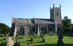
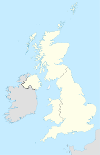
Horringer est un village et une paroisse civile du district de St Edmundsbury, dans le Suffolk. Localisé au bord de l'A143, à environ deux miles au sud-ouest de Bury St Edmunds, le village compte 890 habitants en 2005[1].
Références
Wikimedia Foundation.
2010.
Contenu soumis à la licence CC-BY-SA. Source : Article Horringer de Wikipédia en français (auteurs)
Regardez d'autres dictionnaires:
Horringer Court Middle School — Infobox UK school name = Horringer Court Middle School size = latitude = 52.23569 longitude = 0.68769 dms = dms motto = motto pl = established = approx = closed = c approx = type = religion = president = head label = Headteacher head = Mrs Tania… … Wikipedia
County Upper School — Bury St Edmunds County Upper School Type Academy Headteacher Mrs Vicky Neale Specialism Science College Language College … Wikipedia
H.C. Chambers & Son — Slogan The Oldest Bus Company in the UK Founded … Wikipedia
Thingoe Rural District — infobox historic subdivision Name= Thingoe HQ= Bury St Edmunds Status= Rural district Start= 1894 End= 1974 Replace= St Edmundsbury Borough Thingoe Rural District was a rural district in the county of West Suffolk, England. It was created in 1894 … Wikipedia
List of places in Suffolk — This is a list of cities, towns and villages in the ceremonial county of Suffolk, England. See the list of places in England for places in other counties.compactTOC NOTOC A* Acton, Aldeburgh, Aldham,Aldringham, Alpheton, Ampton, Ashby,… … Wikipedia
Bury St Edmunds (UK Parliament constituency) — UK constituency infobox Name = Bury St Edmunds Map1 = BuryStEdmunds Map2 = Suffolk Type = County Year = Entity = Suffolk County = Suffolk EP = East of England MP = David Ruffley Party = ConservativeBury St Edmunds is a constituency located in… … Wikipedia
Framlingham College — Motto Studio sapientia crescit (Wisdom grows with study) Established 1864 Type Independent school … Wikipedia
List of civil parishes in Suffolk — This is a list of civil parishes in Suffolk, England.BaberghBabergh is entirely parished.Forest HeathForest Heath is entirely parished.IpswichIpswich is entirely unparished.Mid SuffolkMid Suffolk is entirely parished.*Akenham *Ashbocking… … Wikipedia
Culford School — Coordinates: 52°5′43″N 1°18′23″E / 52.09528°N 1.30639°E / 52.09528; 1.30639 … Wikipedia
Middle schools in England — Since the Education Act 1964, it has been possible for local authorities in England and Wales to open Middle schools as part of a three tier education system which cross the traditional primary / secondary divide. Two middle schools were also… … Wikipedia

 Angleterre
