Great South Bay
- Great South Bay
-
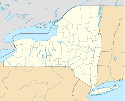
Great South Bay (en français : « Grande baie sud ») est une lagune des États-Unis, longue de plus de 70 kilomètres et large de 10 kilomètres maximum, située au sud de l'île de Long Island, formée de l'espace se trouvant entre cette dernière et Fire Island, ainsi que Jones Beach Island qui les séparent de l'Océan Atlantique.
La lagune est traversée par la Robert Moses Causeway, chaussée construite sur un banc de terre au-dessus de l'eau à laquelle sont associés le Great South Bay Bridge et le Fire Island Inlet Bridge, permettant de relier Long Island à Fire Island.
Wikimedia Foundation.
2010.
Contenu soumis à la licence CC-BY-SA. Source : Article Great South Bay de Wikipédia en français (auteurs)
Regardez d'autres dictionnaires:
Great South Bay — The Great South Bay (actually a lagoon) is an arm of the Atlantic Ocean, approximately 45 mi (72 km) long, forming a large natural harbor on the southern side of Long Island in the U.S. state of New York. It is protected from the open ocean by… … Wikipedia
Great South Bay — Sp Didžióji Pietų įlanka Ap Great South Bay L V Atlante, JAV (Long Ailando s.) … Pasaulio vietovardžiai. Internetinė duomenų bazė
South Bay — There are multiple places in the world known as South Bay.In the USA: * South Bay, Los Angeles, a region of Los Angeles County, southern California * South Bay (San Francisco Bay Area), a subregion of the San Francisco Bay Area * South San Diego … Wikipedia
Great South Wall — The Great South Wall (also sometimes called the South Bull Wall), at the Port of Dublin, extends from Ringsend nearly four miles out into Dublin Bay. It was the world s longest sea wall at the time of its building, remaining one of the longest in … Wikipedia
South Oyster Bay — (actually a lagoon) is a natural harbor along the western portion of the south shore of Long Island in New York in the United States. The harbor is formed by Jones Beach Island, a barrier island on the southern side of Long Island. It is… … Wikipedia
South Fork (New York) — South Fork est le nom de la péninsule des États Unis située sud est de l île de Long Island, entre la Peconic Bay au nord et l Océan Atlantique au sud. Longue d une cinquantaine de kilomètre pour 2 à 12 kilomètres de large, elle est limité à l… … Wikipédia en Français
Bay Shore, New York — Infobox Settlement official name = Bay Shore, New York settlement type = CDP nickname = motto = imagesize = image caption = image pushpin pushpin label position = pushpin map caption =Location within the state of New York pushpin mapsize =… … Wikipedia
Bay Street (Hamilton, Ontario) — Bay Street is a Lower City arterial road in Hamilton, Ontario, Canada. It starts at Aberdeen Avenue, as a collector road with only two lanes, then eventually becomes a six lane thoroughfare at its peak. Bay Street also passes through Downtown… … Wikipedia
Bay City, Michigan — Bay City … Wikipedia
South Africa — Republic of, a country in S Africa; member of the Commonwealth of Nations until 1961. 42,327,458; 472,000 sq. mi. (1,222,480 sq. km). Capitals: Pretoria and Cape Town. Formerly, Union of South Africa. * * * South Africa Introduction South Africa… … Universalium
 États-Unis


 Portail de New York
 Portail du monde maritime
