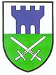
Gosdorf
- Gosdorf
-
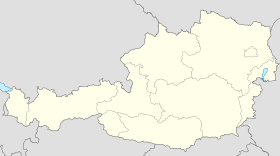
Gosdorf est une commune autrichienne du district de Radkersburg en Styrie.
Géographie
Cette section est vide,
insuffisamment détaillée ou incomplète.
Votre aide est la bienvenue !
Histoire
Cette section est vide,
insuffisamment détaillée ou incomplète.
Votre aide est la bienvenue !
Wikimedia Foundation.
2010.
Contenu soumis à la licence CC-BY-SA. Source : Article Gosdorf de Wikipédia en français (auteurs)
Regardez d'autres dictionnaires:
Gosdorf — Gosdorf … Deutsch Wikipedia
Gosdorf — Infobox Ort in Österreich Art = Gemeinde Name = Gosdorf Wappen = lat deg = 46 | lat min = 43 | lat sec = 33.16 lon deg = 15 | lon min = 47 | lon sec = 41.38 Lageplan = Bundesland = Steiermark Bezirk = Radkersburg Höhe = 234 Fläche = 15.64… … Wikipedia
Gosdorf — Original name in latin Gosdorf Name in other language Gosdorf State code AT Continent/City Europe/Vienna longitude 46.72778 latitude 15.7925 altitude 233 Population 0 Date 2011 07 31 … Cities with a population over 1000 database
Liste der denkmalgeschützten Objekte in Gosdorf — Die Liste der denkmalgeschützten Objekte in Gosdorf enthält die denkmalgeschützten, unbeweglichen Objekte der Gemeinde Gosdorf im steirischen Bezirk Radkersburg, wobei die Objekte teilweise per Bescheid und teilweise durch Verordnung (§ 2a… … Deutsch Wikipedia
Fluttendorf — Wappen Karte … Deutsch Wikipedia
Misselsdorf — Wappen Karte … Deutsch Wikipedia
Bezirk Radkersburg — Lage … Deutsch Wikipedia
Radkersburgerbahn — Radkersburger Bahn Spielfeld Straß–Ljutomer Geografische Daten Staat: Österreich, Slowenien Bundesland: Steiermark Streckendaten Kursbuchstrecke (ÖBB): 560 Streckenlänge: 31,095 km … Deutsch Wikipedia
Госдорф — Коммуна Госдорф Gosdorf Страна АвстрияАвстрия … Википедия
Altneudörfl — Wappen Karte … Deutsch Wikipedia

 Autriche
 Styrie
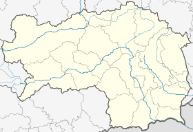

 Gosdorf


