Geograph Britain and Ireland

Geograph Britain and Ireland
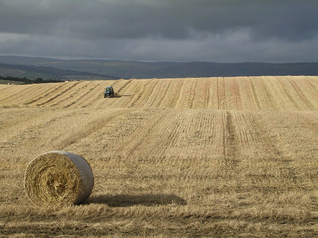
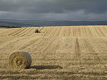
Exemple d’image Geograph en zone rurale.
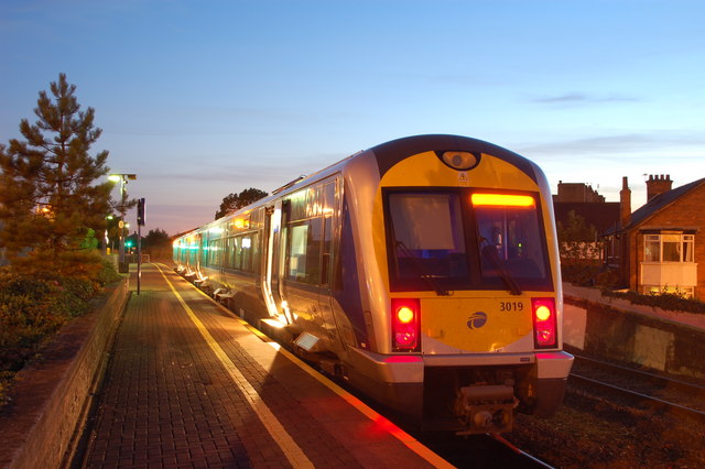
Exemple d’image Geograph en zone urbaine.

Geograph Britain and Ireland est un projet web, débuté en mars 2005, dont le but est de créer une archive en accès libre de photographies géolocalisées de toute la Grande-Bretagne et de l’Irlande. Les photographies sont choisies pour illustrer les parties notables ou typiques de chaque case de 1 km sur 1 km dans le système Irish grid reference system et Ordnance Survey National Grid. Il y a 330 184 cases contenant des terres émergées.

Ce projet est sponsorisé par l’Ordnance Survey.

Sommaire

Contributions

Les images peuvent être apportées par tout utilisateur enregistré, mais elles doivent être approuvées par un ensemble de modérateurs avant d’apparaître sur le site web. L’activité consistant à prendre des photographies pour le projet est connue sous le nom de geographing. Toutes les images sont placées par leurs auteurs sous licence Creative Commons Paternité — Partage des conditions initiales à l’identique (CC-BY-SA 2.0), qui permet la réutilisation et la modification des images sous certaines conditions.

Récompenses

Le site Geograph a été désigné par Yahoo! comme la « découverte 'Voyage' de l’année 2006 » (« Travel Find of the Year 2006 »)[1]

Annexes

Sur les autres projets Wikimedia :

Lien interne

Lien externe

Sources


Wikimedia Foundation. 2010.

Contenu soumis à la licence CC-BY-SA. Source : Article Geograph Britain and Ireland de Wikipédia en français (auteurs)

Игры ⚽ Поможем написать реферат

Regardez d'autres dictionnaires:

  • Geograph British Isles — is a web based project initiated in March 2005 to create a freely accessible archive of geographically located photographs of Great Britain and Ireland. [ [http://www.geograph.org.uk Official website] ] Photographs in the Geograph collection are… …   Wikipedia

  • Tyne and Wear Metro — Overview Type Rapid transit/light rail …   Wikipedia

  • Monmouthshire — For other uses, see Monmouthshire (disambiguation). County of Monmouthshire Sir Fynwy Geography Area Total  % Water …   Wikipedia

  • List of abbeys and priories in England — Contents 1 Overview 1.1 Article layout 2 Abbreviations and key …   Wikipedia

  • Nash, Newport — Pye Corner redirects here. For the statue in London, see Golden Boy of Pye Corner. Coordinates: 51°32′56″N 2°56′46″W / 51.54891667°N 2.946175°W …   Wikipedia

  • Oliver Cromwell — Cromwell redirects here. For other uses, see Cromwell (disambiguation). For other people named Oliver Cromwell, see Oliver Cromwell (disambiguation). Oliver Cromwell Portrait of Oliver Cromwell by Samuel Cooper …   Wikipedia

  • Snowdon — For other uses, see Snowdon (disambiguation). Snowdon (Yr Wyddfa) The Snowdon group seen from the east; left: Y Lliwedd; centre: Crib Goch; right: Yr Wyddfa and Garnedd Ugain …   Wikipedia

  • Cobridge — Coordinates: 53°02′20″N 2°11′12″W / 53.038950°N 2.1866649°W / 53.038950; 2.1866649 …   Wikipedia

  • Coedkernew — Coordinates: 51°33′01″N 3°02′23″W / 51.55028°N 3.03979°W / 51.55028; 3.03979 …   Wikipedia

  • Northampton — This article is about Northampton in England. For other places of the same name, see Northampton (disambiguation). Borough of Northampton   Town Borough   …   Wikipedia

Share the article and excerpts

Direct link
Do a right-click on the link above
and select “Copy Link”