Dibrova

Dibrova
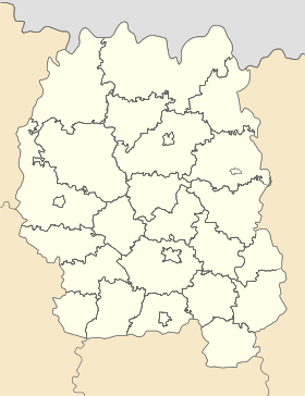
Dibrova
Діброва

Géolocalisation sur la carte : Oblast de Jytomyr

(Voir situation sur carte : Oblast de Jytomyr)
Dibrova

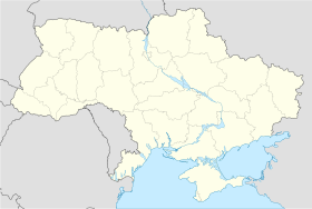
Géolocalisation sur la carte : Ukraine

(Voir situation sur carte : Ukraine)
Dibrova
Coordonnées : 51° 09′ 37″ N 27° 58′ 22″ E / 51.1603, 27.972751° 09′ 37″ N 27° 58′ 22″ E / 51.1603, 27.9727
Pays Drapeau d'Ukraine Ukraine
Subdivision Flag of Zhytomyr Oblast.svg Oblast de Jytomyr
Raïon Olevsk rh.gif Olevsk
Fondation 1569
Statut commune urbaine depuis 1961
Population en diminution 138 hab. (2011)
Densité 93 hab./km²
Altitude 224 m
Superficie 1,48 km2
Indicatif tél. +380 4135
Code postal 11023
Liste des villes d'Ukraine | Carte

Dibrova (en ukrainien : Діброва ; en russe : Диброва ; en polonais : Dąbrowa) est une commune urbaine de l'oblast de Jytomyr, en Ukraine. Sa population s'élevait à 138 habitants en 2011.

Sommaire

Géographie

Dibrova est arrosée par la rivière Jerev (ukrainien : Жерев) et se trouve à 24 km à l'est d'Olevsk, à 111 km au nord-ouest de Jytomyr et à 193 km au nord-ouest de Kiev.

Histoire

Le village de Dibrova a été fondé sous le nom de Drov'ianyï Post (ukrainien : Дров'яний Пост) à la fin du XIXe siècle dans le cadre de la construction de la voie ferrée SarnyKiev. Il a le statut de commune urbaine depuis 1961. Des carrières de pierre à graviers sont exploitées dans les environs.

Population

Recensements (*) ou estimations de la population&nbsp[1] :

Évolution démographique
2001* 2006 2007 2008 2009 2010 138
197 163 160 154 147 140 138

Transports

Dibrova se trouve à 138 km de Jytomyr par le train et à 150 km par la route.

Notes et références

  1. (uk) Office des statistiques d'Ukraine : Статистичний збірник «Чисельність наявного населення України на 1 січня 2008 року» [Manuel statistique « Nombre d'habitants de l'Ukraine au 1er janvier 2008 »]. [1] ; Статистичний збірник «Чисельність наявного населення України на 1 січня 2010 року» [Manuel statistique « Nombre d'habitants de l'Ukraine au 1er janvier 2010 »]. [2] ; Статистичний збірник «Чисельність наявного населення України на 1 січня 2011 року» [Manuel statistique « Nombre d'habitants de l'Ukraine au 1er janvier 2011 »]. [3]

Liens externes


Wikimedia Foundation. 2010.

Contenu soumis à la licence CC-BY-SA. Source : Article Dibrova de Wikipédia en français (auteurs)

Игры ⚽ Поможем написать курсовую

Regardez d'autres dictionnaires:

  • Dibrova (UTS) — Dibrova (Ukrainian: Діброва) is a town (urban type settlement) in Olevsk Raion, Zhytomyr Oblast, Ukraine. The population was 197 (as of 2001).  Administrative divisions of Zhytomyr Oblast, Ukraine …   Wikipedia

  • Northern Maramuresh — is a geographic historical region comprising roughly the eastern half of the Zakarpattia Oblast in southwestern Ukraine, near the border with Romania. Until 1920, it was part of the Maramureş (historical region) of Transylvania, at which time the …   Wikipedia

  • Kiev Bandurist Capella — The Kiev Bandurist Capella ( uk. Київська капeла бандуристiв, Kyivs’ka kapela banduristiv ) is a male vocal chorus that accompanies its singing with the playing of the multi stringed Ukrainian folk instrument known as the bandura. The group was… …   Wikipedia

  • History of Maramureş — Maramureş (in Romanian; Ancient Thracian Maramarista Latin: Marmatia ;Hungarian: Máramaros ; uk. Марамуреш / Maramuresh , Мармарощина / Marmaroshchyna , Мараморщина / Maramorshchyna ) is an historical region in the north of Transylvania, along… …   Wikipedia

  • Novoozerianka — Новоозерянка Géolocalisation sur la carte : Oblast de Jytomyr …   Wikipédia en Français

  • Chernivtsi — This article is about Ukrainian city. For the Israeli writer, see Yemima Avidar Tchernovitz. Chernivtsi Чернівці   City   The square …   Wikipedia

  • Ovruch — Coordinates: 51°19′N 28°48′E / 51.317°N 28.8°E / 51.317; 28.8 Ovruch (Ukrainian …   Wikipedia

  • Novohrad-Volynskyi — Coat of arms of Novohrad Volynskyi Novohrad Volynskyi (historical spellings: Возвягель Vozbyahrel’, Звяголь Zvyahol’, Звягель Zvyahel’, Звягаль Zvyahal’; modern: Ukrainian: Новоград Волинський, translit.: Novohrad Volyns’kyi; Russian: Новоград… …   Wikipedia

  • Radomyshl — (Ukrainian: Радомишль, translit., Radomyshl’) is a historic city in the Zhytomyr Oblast (province) of northern Ukraine. It is the administrative center of the Radomyshl Raion (district), and is located on the left bank of Teteriv River, a right… …   Wikipedia

  • Dolyna — Dolyna …   Wikipedia

Share the article and excerpts

Direct link
Do a right-click on the link above
and select “Copy Link”