- Comté de Cardston
-
Comté de Cardston Administration Pays  Canada
Province  Alberta
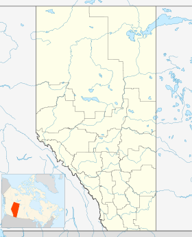
Région Division No.3 Statut municipal District municipal Constitution 1er janvier 1954 Démographie Population 4 037 hab. (2006[1]) Densité 1.2 hab./km2 Géographie Coordonnées
géographiquesSuperficie 3414.87 km2 Géolocalisation sur la carte : Alberta

modifier 
Le comté de Cardston (anglais : Cardston County) est un district municipal du sud-ouest l'Alberta, au Canada.
Municipalités compises
- Ville
- Cardston
- Magrath
- Village
- Glenwood
- Hill Spring
Comtés et districts municipaux limitrophes
Notes et références
- Cardston County, Profils des communautés de 2006 sur Statistique Canada. Consulté le 27 décembre 2009
Catégorie :- Géographie de l'Alberta
- Ville


Wikimedia Foundation. 2010.