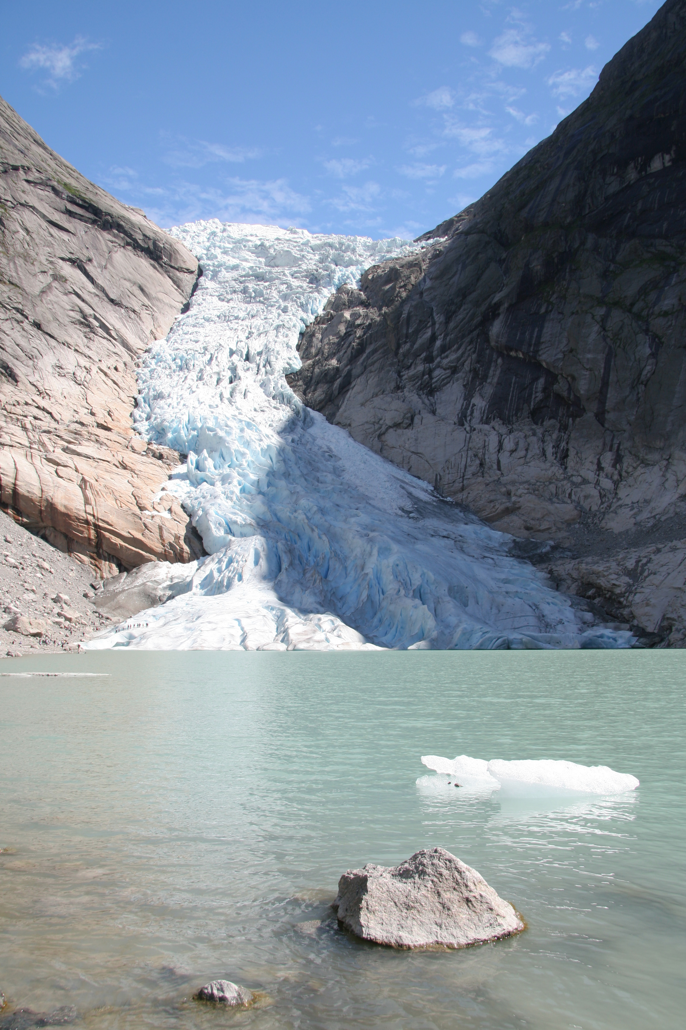
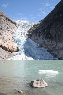
Briksdalsbreen
Contenu soumis à la licence CC-BY-SA. Source : Article Briksdalsbreen de Wikipédia en français (auteurs)
Regardez d'autres dictionnaires:
Briksdalsbreen — (The Briksdal glacier) is one of the most accessible and best known arms of the Jostedalsbreen glacier. Briksdalsbreen lies on the north side of the Jostedalsbreen, in Briksdalen (the Briks valley), up the Oldedalen in Stryn municipality in the… … Wikipedia
Briksdalsbreen — Der Briksdalsbreen in Norwegen ist ein westlicher Nebenarm des größten Festlandsgletschers in Europa, des Jostedalsbreen. Er liegt im Gebiet der Gemeinde Stryn im Norden der Provinz Sogn og Fjordane nördlich des Sognefjords im Jostedalsbreen Nati … Deutsch Wikipedia
Jostedalsbre — Briksdalsbreen, ein Nebenarm des Jostedalsbreen Der Jostedalsbreen in Norwegen ist der größte europäische Festlandsgletscher. Er liegt im Norden der Provinz Sogn og Fjordane nördlich des Sognefjords und ist in Nord Süd Richtung etwa 100 km lang… … Deutsch Wikipedia
Jostedalsbreen — Infobox Glacier glacier name = Jostedalsbreen caption = Briksdalsbreen is one of the more popular parts of Jostedalsbreen type = location = Sogn og Fjordane, NOR coordinates = coord|61|40|N|6|59|E|type:glacier region:NO|display=inline,title area … Wikipedia
Йостедалсбреен (национальный парк) — Национальный парк Йостедалсбреен на данной карте отмечен цифрой 10 … Википедия
Retreat of glaciers since 1850 — The retreat of glaciers since 1850, worldwide and rapid, affects the availability of fresh water for irrigation and domestic use, mountain recreation, animals and plants that depend on glacier melt, and in the longer term, the level of the oceans … Wikipedia
Jostedalsbreen — p1p5 Jostedalsbreen Briksdalsbreen, ein Nebenarm des Jostedalsbreen Höchster Gipfel Lodalskåpa ( … Deutsch Wikipedia
Kerbsohlental — Ein Kerbtal Kerbtäler (auf Grund ihrer häufigen vereinfacht symmetrischen Talhänge auch V Täler genannt) sind Täler, die sich vor allem in Mittel und Hochgebirgen befinden. Häufig sind sie an ihrer Sohle so schmal, dass sie als Engtal gelten… … Deutsch Wikipedia
V-Tal — Ein Kerbtal Kerbtäler (auf Grund ihrer häufigen vereinfacht symmetrischen Talhänge auch V Täler genannt) sind Täler, die sich vor allem in Mittel und Hochgebirgen befinden. Häufig sind sie an ihrer Sohle so schmal, dass sie als Engtal gelten… … Deutsch Wikipedia
Stryn — Infobox Kommune name = Stryn idnumber = 1449 county = Sogn og Fjordane landscape = Nordfjord capital = Stryn demonym = Stryning language = Nynorsk munwebpage = www.stryn.kommune.no governor = Nils P. Støyva (Ap) governor as of = 1999 arearank =… … Wikipedia
 Norvège