Billinghay
- Billinghay
-
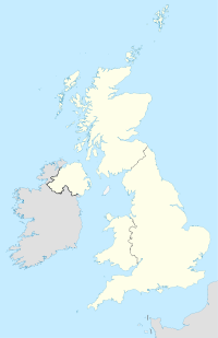
Billinghay est un petit village du Lincolnshire, au Nord-Est de l'Angleterre, situé à une quinzaine de kilomètres de Sleaford.
Billinghay compte environ 1800 habitants au recensement de 2001.
Lieux d'intérêt
On trouve à Billinghay une église ayant un intérêt historique, datant du XIIIe siècle.
Jumelage
Wikimedia Foundation.
2010.
Contenu soumis à la licence CC-BY-SA. Source : Article Billinghay de Wikipédia en français (auteurs)
Regardez d'autres dictionnaires:
Billinghay — is a village and civil parish in the North Kesteven district of Lincolnshire, England, about ten miles north east of Sleaford. According to the 2001 census the parish had a population of 1,808. The village lies along the B1189 (for Walcott) near… … Wikipedia
Billinghay — Original name in latin Billinghay Name in other language Billinghay State code GB Continent/City Europe/London longitude 53.07959 latitude 0.27689 altitude 9 Population 1702 Date 2011 02 13 … Cities with a population over 1000 database
Ballon (Sarthe) — Pour les articles homonymes, voir Ballon. 48° 10′ 36″ N 0° 14′ 09″ E … Wikipédia en Français
Saint-Ouen-sous-Ballon — Ballon (Sarthe) Pour les articles homonymes, voir Ballon. Ballon Administration Pays France Région Pays de la Loire Département … Wikipédia en Français
Dogdyke — Coordinates: 53°04′58″N 0°11′39″W / 53.082705°N 0.19421943°W / 53.082705; 0.19421943 … Wikipedia
The Fens — The Fens, also known as the Fenland, is a geographic area in eastern England, in the United Kingdom. The Fenland primarily lies around the coast of the Wash; it reaches into two Government regions (East Anglia and the East Midlands), four modern… … Wikipedia
Lincolnshire County Council elections, 2005 — Elections for Lincolnshire County Council, which covers the county of Lincolnshire were held on 5th May 2005.Election Summary Party party = Conservative Party (UK) seats = 45 gain = loss = net = seats % = votes % = votes = plus/minus = Election… … Wikipedia
Michael Francis Gilbert — Michael Francis Gilbert, (* 17. Juli 1912 in Billinghay, Lincolnshire, England; † 8. Februar 2006 in Luddesdown, Kent, England) war ein britischer Schriftsteller. Gilbert war lange Jahre Rechtsanwalt in London, einer seiner Klienten war Raymond… … Deutsch Wikipedia
River Witham — Geobox River name = River Witham map size = map caption = other name = Witham other name1 = country = England country1 = region = Lincolnshire region1 = city = Lincoln city1 = length = 132 length imperial = 82 watershed = watershed imperial =… … Wikipedia
Metheringham — Coordinates: 53°08′21″N 0°24′12″W / 53.1391°N 0.4034°W / 53.1391; 0.4034 … Wikipedia
 Angleterre
