Bekond

Bekond
Bekond
Blason de Bekond
Germany location map.svg
Bekond
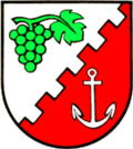
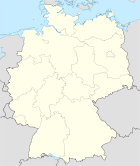
Administration
Toponyme officiel Bekond
Pays Drapeau d'Allemagne Allemagne
Land Rhénanie-Palatinat
Arrondissement
(Landkreis)
Trèves-Sarrebourg
Code communal
(Gemeindeschlüssel)
07 2 35 004
Code postal 54340
Indicatif téléphonique 06502
Immatriculation TR
Politique
Bourgmestre
(Ortsbürgermeister)
Paul Reh
Partis au pouvoir
Géographie
Coordonnées 49° 50′ 57″ N 6° 48′ 02″ E / 49.849167, 6.80055649° 50′ 57″ Nord
       6° 48′ 02″ Est
/ 49.849167, 6.800556
  
Altitude (NN) 220 m
Superficie 3,81 km2
Démographie
Population 798 hab. (2009)
Densité 208 hab./km2

Bekond est une municipalité du Verbandsgemeinde Schweich an der Römischen Weinstraße, dans l'arrondissement de Trèves-Sarrebourg, en Rhénanie-Palatinat, dans l'ouest de l'Allemagne.

References


Wikimedia Foundation. 2010.

Contenu soumis à la licence CC-BY-SA. Source : Article Bekond de Wikipédia en français (auteurs)

Игры ⚽ Нужен реферат?

Regardez d'autres dictionnaires:

  • Bekond — Wappen Deutschlandkarte …   Deutsch Wikipedia

  • Bekond — Infobox Ort in Deutschland Art = Ortsgemeinde image photo = Wappen = Wappen bekond.gif lat deg = 49 |lat min = 50 |lat sec = 57 lon deg = 6 |lon min = 48 |lon sec = 2 Lageplan = Bundesland = Rheinland Pfalz Landkreis = Trier Saarburg… …   Wikipedia

  • Bekond — Original name in latin Bekond Name in other language State code DE Continent/City Europe/Berlin longitude 49.85 latitude 6.8 altitude 216 Population 829 Date 2011 04 25 …   Cities with a population over 1000 database

  • Liste der Kulturdenkmäler in Bekond — Kirchstraße ohne Nummer: Katholische Pfarrkirche St. Klemens In der Liste der Kulturdenkmäler in Bekond sind alle Kulturdenkmäler der rheinland pfälzischen Ortsgemeinde Bekond aufgeführt. Grundlage ist die Denkmalliste des Landes Rheinland Pfalz… …   Deutsch Wikipedia

  • St. Thomas am Brunnenhof — (Bekond,Германия) Категория отеля: Адрес: Kirchstr 2, 54340 Bekond, Герман …   Каталог отелей

  • Fastrau — Wappen Deutschlandkarte …   Deutsch Wikipedia

  • Kahlenbach (Fluss) — Vorlage:Infobox Fluss/BILD fehltVorlage:Infobox Fluss/DGWK fehltVorlage:Infobox Fluss/ABFLUSS altVorlage:Infobox Fluss/ABFLUSS fehltVorlage:Infobox Fluss/KARTE fehlt Kahlenbach Lage Rheinland Pfalz; Deutschland Länge 3,3 km …   Deutsch Wikipedia

  • Lörsch — Wappen Deutschlandkarte …   Deutsch Wikipedia

  • Mehringer Schweiz — Wappen Deutschlandkarte …   Deutsch Wikipedia

  • Schweich-Issel — Wappen Deutschlandkarte …   Deutsch Wikipedia

Share the article and excerpts

Direct link
Do a right-click on the link above
and select “Copy Link”