- Bauler (bei Adenau)
-
Bauler 

Administration Toponyme officiel Bauler Pays  Allemagne
Land  Rhénanie-Palatinat
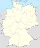
Arrondissement
(Landkreis)Arrondissement d'Ahrweiler Code communal
(Gemeindeschlüssel)07 1 31 009 Code postal 53534 Indicatif téléphonique 02692 Immatriculation AW Site web www.adenau.de/ Politique Bourgmestre
(Bürgermeister)Raimund Michels Partis au pouvoir Géographie Coordonnées Altitude (NN) 430 m Superficie 2.34 km2 Démographie Population 51 hab. (31/12/2008) Densité 22 hab./km2 modifier 
Bauler est une municipalité allemande située dans le land de Rhénanie-Palatinat et l'arrondissement d'Ahrweiler.
Source
- (de) Cet article est partiellement ou en totalité issu de l’article de Wikipédia en allemand intitulé « Bauler (bei Adenau) » (voir la liste des auteurs)
Catégorie :- Commune de Rhénanie-Palatinat


Wikimedia Foundation. 2010.