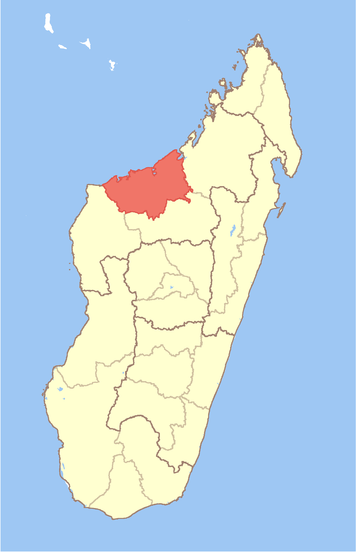
Andranomavo
- Andranomavo
-
16° 34′ 00″ S 45° 35′ 00″ E / -16.566667, 45.583333
Andranomavo est une commune urbaine malgache située dans la partie ouest de la région de Boeny.
Géographie
Cette section est vide, insuffisamment détaillée ou incomplète.
Votre aide est la bienvenue !
Démographie
Cette section est vide, insuffisamment détaillée ou incomplète.
Votre aide est la bienvenue !
Économie
Cette section est vide, insuffisamment détaillée ou incomplète.
Votre aide est la bienvenue !
Notes et références
Voir aussi
Articles connexes
Wikimedia Foundation.
2010.
Contenu soumis à la licence CC-BY-SA. Source : Article Andranomavo de Wikipédia en français (auteurs)
Regardez d'autres dictionnaires:
Andranomavo — Infobox Settlement official name = Andranomavo other name = native name = nickname = settlement type = motto = imagesize = image caption = flag size = image seal size = image shield = shield size = image blank emblem = blank emblem type = blank… … Wikipedia
Mahajanga — [maːˈdzaŋɡə̥] (French: Majunga) is a city and a district on the north west coast of Madagascar. Contents 1 City 2 District … Wikipedia
Marosakoa — Marosakoa … Wikipedia
Mitsinjo — Mitsinjo … Wikipedia
Marovoay — Marovoay … Wikipedia
Manaratsandry — Manaratsandry … Wikipedia
Marovoay Banlieue — Marovoay Banlieue … Wikipedia
Manerinerina — Manerinerina … Wikipedia
Mahajamba Usine — Mahajamba Usine … Wikipedia
Mariarano — Mariarano … Wikipedia
 Madagascar