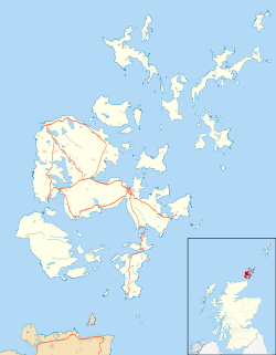
Pentland Firth
Contenu soumis à la licence CC-BY-SA. Source : Article Pentland Firth de Wikipédia en français (auteurs)
Regardez d'autres dictionnaires:
Pentland Firth — Dunnet Head, Blick über den Pentland Firth nach Hoy Verbindet Gewässer Nordsee mit Gewässer … Deutsch Wikipedia
Pentland Firth — Pentland Firth, Meerenge des Atlantischen Ozeans, zwischen den Orkneyinseln und der Nordküste von Schottland, 23 km lang, am Osteingang zwischen dem Duncansby Head und der Insel South Ronaldshay 10 km breit. Das Meer hat hier so heftige… … Meyers Großes Konversations-Lexikon
Pentland Firth — (spr. pénntländ förth), Meerenge zwischen den Orkneyinseln und dem schott. Festlande, 23 km lg., 10 13 km br … Kleines Konversations-Lexikon
Pentland Firth — [pent′lənd] channel between the mainland of Scotland & the Orkney Islands: 6 8 mi (9.7 12.9 km) wide * * * … Universalium
Pentland Firth — [ pentlənd fəːθ], Meeresstraße zwischen Schottland und den Orkneyinseln, 23 km lang, 10 13 km breit; für die Schifffahrt durch starke Gezeitenströme gefährlich. … Universal-Lexikon
Pentland Firth — [pent′lənd] channel between the mainland of Scotland & the Orkney Islands: 6 8 mi (9.7 12.9 km) wide … English World dictionary
Pentland Firth — The Pentland Firth (Scottish Gaelic: An Caol Arcach , meaning the Orcadian Strait), which is actually more of a strait than a firth, separates the Orkney Islands from Caithness in the north of Scotland. The name is presumed to be a corruption of… … Wikipedia
Pentland Firth — Sp Peñtlando fjòrdas Ap Pentland Firth L tarp Orknio ss. ir Š Škotijos, D. Britanija … Pasaulio vietovardžiai. Internetinė duomenų bazė
Pentland Firth — geographical name channel between Orkneys & mainland of Scotland … New Collegiate Dictionary
PENTLAND FIRTH — is the strait between the Orkneys and the Scottish mainland connecting the North Sea with the Atlantic, 12 m. long by 6 broad, and swept by a rapid current very dangerous to navigation; 5000 vessels traverse it annually … The Nuttall Encyclopaedia

 Royaume-Uni


