White Waltham
- White Waltham
-
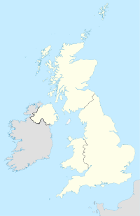
White Waltham est un village du Berkshire,Angleterre. Ce village est situé à environ 3 km au sud-ouest de Maidenhead.
Wikimedia Foundation.
2010.
Contenu soumis à la licence CC-BY-SA. Source : Article White Waltham de Wikipédia en français (auteurs)
Regardez d'autres dictionnaires:
White Waltham — infobox UK place country = England official name= White Waltham population= 2,881 unitary england= Windsor and Maidenhead region= South East Englandlieutenancy england= Berkshire constituency westminster= Maidenhead post town= Maidenhead postcode … Wikipedia
White Waltham — Original name in latin White Waltham Name in other language State code GB Continent/City Europe/London longitude 51.48833 latitude 0.77844 altitude 38 Population 0 Date 2011 07 31 … Cities with a population over 1000 database
White Waltham Airfield — ] The airfield was set up in 1928 when the de Havilland family bought 196 acres of grassland to house the de Havilland Flying School. In 1938 the airfield was taken over by the government, and during the second world war was the home base of the… … Wikipedia
Waltham St Lawrence — is a small village and civil parish in the English county of Berkshire.Location and amenitiesWaltham St Lawrence is located in a rural setting in East Berkshire, south of the A4 trunk road and north of the M4 motorway, between Maidenhead and… … Wikipedia
Waltham — may refer to:PlacesIn Canada: *Waltham, QuebecIn England: *Bishops Waltham, Hampshire *London Borough of Waltham Forest **including Walthamstow ***that includes Walthamstow Village *Waltham, Kent *Waltham, Lincolnshire **New Waltham is nearby… … Wikipedia
White House of the Chickasaws — U.S. National Register of Historic Places … Wikipedia
Waltham, Massachusetts — Infobox Settlement official name = Waltham, Massachusetts nickname = The Watch City motto = imagesize = 250px image caption = Waltham on the banks of the Charles River image mapsize = 250px map caption = Location in Middlesex County in… … Wikipedia
Waltham Abbey, Essex — infobox UK place country = England official name= Waltham Abbey latitude= 51.6846 longitude= 0.0004 population = 20,400 shire district= Epping Forest shire county = Essex region= East of England constituency westminster= Epping Forest post town=… … Wikipedia
Waltham Holy Cross Urban District — infobox historic subdivision Name= Waltham Holy Cross HQ= Government= Waltham Holy Cross Urban District Council Origin= Waltham Holy Cross parish Status= Urban district Start= 1894 End= 1974 Code= CodeName= Replace= Epping Forest District Motto=… … Wikipedia
Waltham Cross — infobox UK place country = England official name= Waltham Cross static population = 10,000 shire district= Broxbourne shire county = Hertfordshire region= East of England constituency westminster= Broxbourne post town= WALTHAM CROSS postcode… … Wikipedia
 Angleterre
