West-Knollendam
Contenu soumis à la licence CC-BY-SA. Source : Article West-Knollendam de Wikipédia en français (auteurs)
Regardez d'autres dictionnaires:
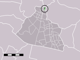
West-Knollendam — Dutch town locator maps mun town caption = The town centre (dark green) and the statistical district (light green) of West Knollendam in the municipality of Zaanstad.West Knollendam (coord|52|31|N|4|47|E|type:city(468)) is a town in the Dutch… … Wikipedia
Westknollendam — West Knollendam 52°31′4″N 4°47′11″E / 52.51778, 4.78639 … Wikipédia en Français
Markervaart — Caractéristiques Longueur 3,9 km Mouillage 2 à 3 m m … Wikipédia en Français
Zaan — J. den Uylbrug (Benannt nach dem ehemaligen niederländischen Ministerpräsidenten Joop den UylVorlage:Infobox Fluss/KARTE fe … Deutsch Wikipedia
Liste des localités des Pays-Bas par code postal — Cette page est une liste des localités (villes, villages) des Pays Bas par code postal. Les localités ne possédant pas leur propre code postal ne figurent pas dans cette liste. Sommaire 1 1000 1999 1.1 1000 1099 1.2 1100 1199 … Wikipédia en Français
Zaan — The Zaan is a small river in the province of North Holland in The Netherlands.The river was originally a side arm of the IJ bay. It runs about 10 kilometers through the municipality of Zaanstad ( Zaan City ) north of Amsterdam, from West… … Wikipedia
Zaans — is a dialect of Dutch spoken in the Zaan district, which lies north of Amsterdam, in the Dutch province of North Holland. Zaans is one of the oldest dialects in the country. The dialect has similaries to the West Frisian dialect which is spoken… … Wikipedia
Assendelft — 52° 28′ 01″ N 4° 44′ 32″ E / 52.4669, 4.74222 … Wikipédia en Français
Koog Aan De Zaan — Situation de Koog aan de Zaan dans la commune de Zaanstad. Koog aan de Zaan es … Wikipédia en Français
Koog aan de Zaan — 52°28′N 4°48′E / 52.467, 4.8 … Wikipédia en Français
 Pays-Bas

