Vražogrnac

Vražogrnac
Vražogrnac
Вражогрнац
Administration
Pays Drapeau de Serbie Serbie
Province Serbie centrale
Région Timočka Krajina
District Zaječar
Ville Zaječar
Code postal 19 312
Géographie
Coordonnées 43° 57′ 33″ Nord
       22° 19′ 21″ Est
/ 43.9592, 22.3225
Altitude 111 m
Démographie
Population 1 340 hab. (2002)
Localisation
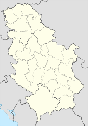
Serbia location map.svg
City locator 14.svg
Vražogrnac

Vražogrnac (en serbe cyrillique : Вражогрнац) est une localité de Serbie située sur le territoire de la Ville de Zaječar, district de Zaječar. En 2002, elle comptait 1 340 habitants[1], dont une majorité de Serbes.

Vražogrnac, officiellement classé parmi les villages de Serbie, est situé sur les bords du Timok.

Sommaire

Démographie

Évolution historique de la population

Évolution démographique
1948 1953 1961 1971 1981 1991 2002
2 201 2 246 2 283 2 229 2 060 1 645 1 340[1]

En 2010, la population de Vražogrnac était estimée à 1 156 habitants[2].

Répartition de la population (2002)

Nationalité Nombre %
Serbes 1 304 97,31
Valaques 16 1,19
Macédoniens 3 0,22
Roumains 1 0,07
Roms 1 0,07
Bulgares 1 0,07
Yougoslaves 1 0,07
Inconnus/Autres[3]

Notes et références

  1. a et b (sr) Livre 9, Population, analyse comparative de la population en 1948, 1953, 1961, 1971, 1981, 1991 et 2002, données par localités, Institut de statistique de la République de Serbie, Belgrade, mai 2004 (ISBN 86-84433-14-9)
  2. (fr) Vražogrnac sur http://gazetteer.de, World Gazetteer. Consulté le 18 octobre 2011
  3. (sr) Livre 1, Population, origine nationale ou ethnique, données par localités, Institut de statistique de la République de Serbie, Belgrade, février 2003 (ISBN 86-84433-00-9)

Voir aussi

Articles connexes

Liens externes


Wikimedia Foundation. 2010.

Contenu soumis à la licence CC-BY-SA. Source : Article Vražogrnac de Wikipédia en français (auteurs)

Игры ⚽ Поможем решить контрольную работу

Regardez d'autres dictionnaires:

  • Vrazogrnac — Vražogrnac Vražogrnac Вражогрнац [[Image:|100px|center|Blason]] [[Image:|100px|center|Drapaeau]] Héraldique Drapeau …   Wikipédia en Français

  • Zajecar — Zaječar Zaječar Зајечар [[Image:|100px|center|Drapaeau]] Héraldique Drape …   Wikipédia en Français

  • Zaječar — Зајечар Héraldique …   Wikipédia en Français

  • Zaјеcar — Zaječar Zaječar Зајечар [[Image:|100px|center|Drapaeau]] Héraldique Drape …   Wikipédia en Français

  • Zaјеčar — Zaječar Zaječar Зајечар [[Image:|100px|center|Drapaeau]] Héraldique Drape …   Wikipédia en Français

  • Zaječar — Infobox Serbia municipality native name = Град Зајечар|official name=City of Zaječar image shield =COA zajecar.png district = Zaječar mayor = Boško Ničić (LS) area km2 = 1068 population total = 39491 | mpop = 65969 latd = 43| latm = 55|longd =… …   Wikipedia

  • Timok River — Infobox River | river name = Timok (Тимок) caption = Timok watershed origin = Svrljig mountains, Serbia mouth = Danube, northernmost point of the Bulgarian Serbian border basin countries = Serbia, Bulgaria length = 203 km elevation = 1,078 m… …   Wikipedia

  • List of cities, towns and villages in Serbia — This is the complete list of settlements in Serbia without Kosovo, as recorded by 2002 census, sorted by municipalities. Settlements denoted as urban (towns and cities) are marked bold. Population for every settlement is given in brackets. The… …   Wikipedia

  • List of settlements in Serbia (alphabetic) — This is the complete list of settlements in Serbia without Kosovo, as recorded by 2002 census, in alphabetic order. Settlements denoted as urban (towns and cities) are marked bold. Population for every settlement is given in brackets. The same… …   Wikipedia

  • Gemeinde Zaječar — Oпштина Зајечар Opština Zaječar Gemeinde Zaječar Wappen …   Deutsch Wikipedia

Share the article and excerpts

Direct link
Do a right-click on the link above
and select “Copy Link”