Tetbury
- Tetbury
-
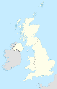
Tetbury est une petite ville et une paroisse civile anglaise située dans le district de Cotswold et le comté du Gloucestershire. Elle repose sur le site d'un ancien fort, au-dessus duquel un monastère anglo-Saxon fut fondé en 681, probablement par Ina de Wessex. La population de la paroisse est de 5 250 habitants en 2001.
Au Moyen Âge, Tetbury est un centre important d'échange de laine et de fil des Cotswold. C'est à cette époque que fut fondé la course annuelle toujours en vigueur actuellement, nommée Tetbury Woolsack Races pendant laquelle les participants portent un sac de 60 livres de laine au sommet d'une colline.
Notes et références
Wikimedia Foundation.
2010.
Contenu soumis à la licence CC-BY-SA. Source : Article Tetbury de Wikipédia en français (auteurs)
Regardez d'autres dictionnaires:
Tetbury — (spr. téttbĕrĭ), alte Stadt in Gloucestershire (England), 16 km südwestlich von Cirencester, auf einer Anhöhe über dem Avon, hat eine schöne gotische Kirche (18. Jahrh.), Getreidehandel und (1901) 1989 Einwohner … Meyers Großes Konversations-Lexikon
Tetbury — infobox UK place country = England official name= Tetbury latitude= 51.635683 longitude= 2.158238 population= 5,250 (2001 Census) shire district= Cotswold shire county= Gloucestershire region= South West England constituency westminster= Cotswold … Wikipedia
Tetbury — Original name in latin Tetbury Name in other language Tetbury State code GB Continent/City Europe/London longitude 51.63944 latitude 2.16222 altitude 118 Population 5367 Date 2012 02 01 … Cities with a population over 1000 database
Tetbury Upton — is a Civil Parish in the Cotswolds area of Gloucestershire. [ [http://www.visionofbritain.org.uk/unit page.jsp?u id=10392986 Profile of Tetbury Upton, Glouscesterhsire] ] Tetbury is situated on the B4014 immediately north of the town of Tetbury.… … Wikipedia
Tetbury Woolsack Races — The Tetbury Woolsack Races are held on the Whitsun Bank Holiday Monday. Hundreds of people line up along Gumstool Hill (an extremely steep street) in the centre of Tetbury, Gloucestershire to watch the teams. Each competitor must carry a full… … Wikipedia
St Saviour's Church, Tetbury — St Saviour s Church, Tetbury, from the north … Wikipedia
Sir William Romney's School, Tetbury — Sir William Romney s School is a secondary school in Tetbury, with students aged 11 18.Performing Arts statusixth FormDespite a fight in recent years to keep the school s sixth form from closing, Sir William Romney s 16 18 provision will shut… … Wikipedia
Malmesbury — For other uses, see Malmesbury (disambiguation). Coordinates: 51°35′02″N 2°05′56″W / 51.5840°N 2.0988°W / 51.5840; 2.0988 … Wikipedia
List of abbeys and priories in England — Contents 1 Overview 1.1 Article layout 2 Abbreviations and key … Wikipedia
Nailsworth railway station — Nailsworth Location Place Nailsworth Area Stroud Coordinates … Wikipedia
 Angleterre
