Stourport-on-Severn
Contenu soumis à la licence CC-BY-SA. Source : Article Stourport-on-Severn de Wikipédia en français (auteurs)
Regardez d'autres dictionnaires:
Stourport-on-severn — Stourport on Severn … Wikipédia en Français
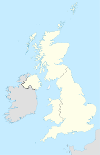
Stourport-on-Severn — infobox UK place country = England official name= Stourport on Severn latitude= 52.34182 longitude= 2.27624 population = 19,713 shire district= Wyre Forest shire county = Worcestershire region= West Midlands constituency westminster= Wyre Forest… … Wikipedia
Stourport-on-Severn — 52.34182 2.27624 Koordinaten: 52° 21′ N, 2° 17′ W … Deutsch Wikipedia
Stourport-on-Severn — Original name in latin Stourport on Severn Name in other language Stourport, Stourport On Severn State code GB Continent/City Europe/London longitude 52.35 latitude 2.26667 altitude 25 Population 19713 Date 2012 03 29 … Cities with a population over 1000 database
Severn Valley Railway — Heritage Railway name = Severn Valley Railway locale = Bewdley, Worcestershire terminus = Bridgnorth, Shropshire linename = Severn Valley Line builtby = Great Western Railway originalgauge = RailGauge|ussg preservedgauge = RailGauge|ussg operator … Wikipedia
Stourport Swifts F.C. — Football club infobox clubname = Stourport Swifts fullname = Stourport Swifts Football Club nickname = Swifts founded = 1882 ground = Walshes Meadow Stourport on Severn Worcestershire capacity = 2,000 (250 seated) chairman = Chris Reynolds… … Wikipedia
Severn Way — The Severn Way [http://www.geograph.org.uk/photo/85902] is a waymarked [http://www.geograph.org.uk/photo/6687] long distance footpath in the United Kingdom following the course of the River Severn [http://www.geograph.org.uk/photo/118846] in the… … Wikipedia
Stourport — (spr. ßtūr pōrt), Stadt in Worcestershire (England), an der Mündung des Stour in den Severn, mit Spinnerei, Teppichweberei und (1901) 4529 Einw … Meyers Großes Konversations-Lexikon
Stourport Ring — The Stourport Ring is a connected series of canals forming a circuit, or canal ring, around Worcestershire, The Black Country and Birmingham in central England. The ring is formed from the River Severn, the Staffordshire and Worcestershire Canal … Wikipedia
Severn, River — Welsh Hafren ancient Sabrina River, eastern Wales and western England. Britain s longest river, it is 180 mi (290 km) long from its source to tidal waters. It rises in east central Wales and crosses the English border near Shrewsbury, continuing… … Universalium
 Angleterre
 Villeneuve-le-Roi (France) depuis le 25 septembre 1971

