Sedbury
Contenu soumis à la licence CC-BY-SA. Source : Article Sedbury de Wikipédia en français (auteurs)
Regardez d'autres dictionnaires:
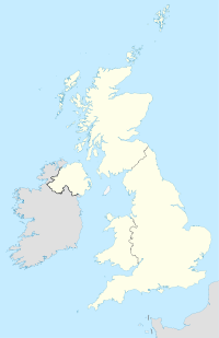
Sedbury — is a village in the Forest of Dean district of west Gloucestershire, England.It is on the eastern bank of the River Wye, facing the Welsh town of Chepstow. The village is in the parish of Tidenham.Historically Sedbury sits alongside the southern… … Wikipedia
Gilling with Hartforth and Sedbury — is a civil parish in North Yorkshire, England. It includes the villages of Gilling West and Hartforth … Wikipedia
Chepstow — Coordinates: 51°38′31″N 2°40′30″W / 51.642°N 2.675°W / 51.642; 2.675 … Wikipedia
George Ormerod — Infobox Person name = George Ormerod image size = 200px caption = George Ormerod birth date = October 20 1785 birth place = Manchester, Lancashire, England death date = October 9 1873 death place = Sedbury, Gloucestershire, England education =… … Wikipedia
Offa's Dyke Path — Offas Dyke Path A marker post on Offa s Dyke Length 177 miles (285 km) Location English/Welsh border Designation National Trail … Wikipedia
Tidenham — is a village and civil parish in the Forest of Dean of west Gloucestershire, England, close to the Welsh border.The parish includes the villages of Tidenham, Beachley, Boughspring, Sedbury, Tutshill and Woodcroft, and according to the United… … Wikipedia
Wyedean School — Infobox UK school name = Wyedean School 6th Form Centre size = latitude = 51.64233 longitude = 2.66019 dms = dms motto = motto pl = established = 1973 approx = closed = c approx = type = Comprehensive religion = president = head label =… … Wikipedia
North Gloucestershire League — North Gloucestershire Association Football League Countries England … Wikipedia
Marling Baronets — The Marling Baronetcy, of Stanley Park and Sedbury Park in the County of Gloucester, is a title in the Baronetage of the United Kingdom. It was created on 22 May 1882 for the cloth manufacturer and Liberal politician Samuel Marling. The second… … Wikipedia
Cade (horse) — Thoroughbred racehorse infobox horsename = Cade caption = sire = Godolphin Arabian grandsire = Unknown dam = Lady Roxana damsire = Bald Galloway sex = Stallion foaled = 1734 country = Great Britain flagicon|UK colour = Bay breeder = Francis… … Wikipedia


