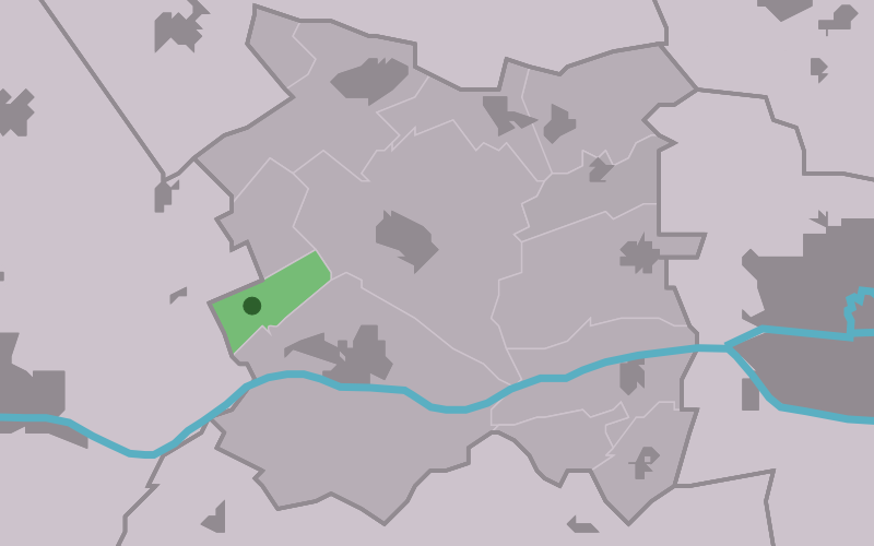
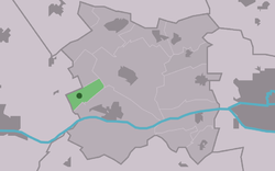
Schingen
Contenu soumis à la licence CC-BY-SA. Source : Article Schingen de Wikipédia en français (auteurs)
Regardez d'autres dictionnaires:
Mebusmühle — 51.1597222222227.22722222222227Koordinaten: 51° 10′ N, 7° 14′ O Die Mebusmühle ist ein Wohnplatz an einer ehemali … Deutsch Wikipedia
Mebusmühle (Remscheid) — 51.1597222222227.2272222222222 Koordinaten: 51° 10′ N, 7° 14′ O … Deutsch Wikipedia
Remscheid Mebusmühle — 51.1597222222227.22722222222227Koordinaten: 51° 10′ N, 7° 14′ O Die Mebusmühle ist ein Wohnplatz an einer ehemali … Deutsch Wikipedia
Skingen — 53°12′6″N 5°37′3″E / 53.20167, 5.6175 … Wikipédia en Français
C. & F. Schnabel — Die Tuchfabrik C. F. Schnabel im 19. Jahrhundert Die Tuchfabrik C. F. Schnabel war eine der großen Tuchfabriken in Hückeswagen. Sie befand sich an der Wupper nahe der Ortschaft Hummeltenberg und entstand aus der Hummeltenberger Mühle. C. F.… … Deutsch Wikipedia
Menaldumadeel — Infobox Settlement official name = Menaldumadeel other name = Menameradiel image seal size = 70px mapsize = 280px subdivision type = Country subdivision name = Netherlands subdivision type1 = Province subdivision name1 = Friesland area footnotes … Wikipedia
List of places in the Netherlands — This is an alphabetical list of places (cities, towns, villages) in the Netherlands. Lists per province can be found at:* List of towns in Groningen * List of towns in Friesland * List of towns in Drente * List of towns in Overijssel * List of… … Wikipedia
Lieblingshof — Infobox Ort in Deutschland Wappen = kein lat deg = 54 | lat min = 1 lon deg = 12 | lon min = 19 Lageplan = Lieblingshof in DBR.png Lageplanbeschreibung = Bundesland = Mecklenburg Vorpommern Landkreis = Bad Doberan Amt = Warnow Ost Höhe = 40… … Wikipedia
Roman Catholic Diocese of Kikwit — Infobox Diocese| jurisdiction=Diocese name= Kikwit latin= Dioecesis Kikuitensis country= Democratic Republic of the Congo metropolitan=Kinshasa rite=Latin Rite cathedral = cocathedral = area= 62,000 population= 3,809,220 population as of= 2004… … Wikipedia
Beetgum — 53°14′12″N 5°41′15″E / 53.23667, 5.6875 … Wikipédia en Français
 Pays-Bas
 Portail des Pays-Bas