Patscherkofel
- Patscherkofel
-
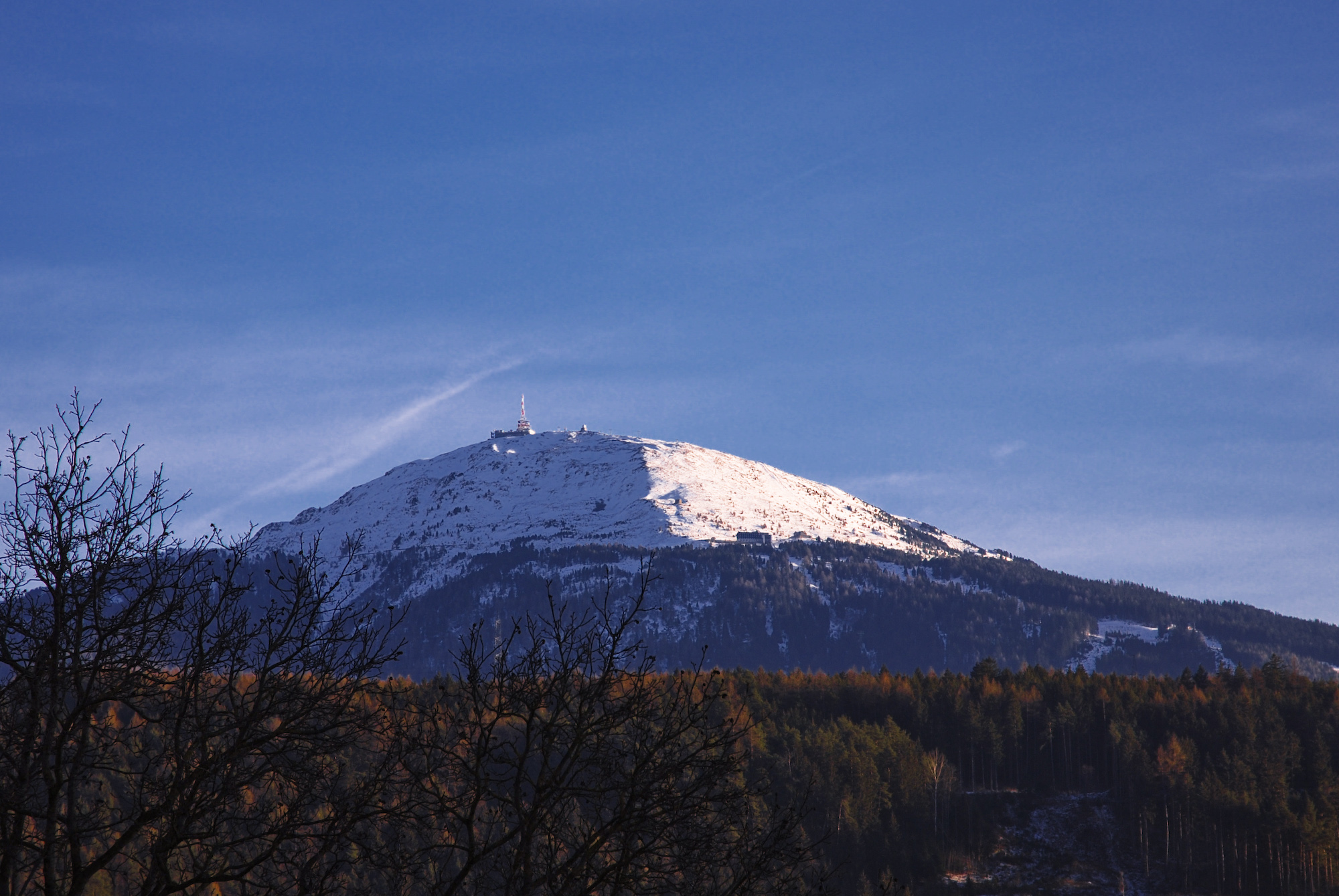
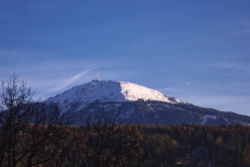
Le Patscherkofel est un sommet des Alpes, à 2 246 m d'altitude, dans le massif des Alpes de Tux, en Autriche (Tyrol).
|
|
|
| Délégations |
| Amérique |
Argentine • Canada • Chili • États-Unis
|
| Asie |
Corée du Nord • Corée du Sud • Inde • Iran • Japon • Liban • Mongolie
|
| Europe |
Allemagne • Autriche • Belgique • Bulgarie • Danemark • Espagne • Finlande • France • Grande- Bretagne • Grèce • Hongrie • Islande • Italie • Liechtenstein • Norvège • Pays- Bas • Pologne • Roumanie • Suède • Suisse • Union soviétique • Tchécoslovaquie • Turquie • Yougoslavie
|
| Océanie |
Australie
|
|
| Sites |
|
| Médaillés - Tableau des médailles |
Catégories : - Sommet des Alpes autrichiennes
- Montagne du Tyrol
Wikimedia Foundation.
2010.
Contenu soumis à la licence CC-BY-SA. Source : Article Patscherkofel de Wikipédia en français (auteurs)
Regardez d'autres dictionnaires:
Patscherkofel — von Innsbruck aus Höhe 2.246 m ü.� … Deutsch Wikipedia
Patscherkofel — Patscherkofel, Berg südlich von Innsbruck, mit zwei Kuppen (2248 und 2217 m), wird wegen seiner schönen Rundsicht und leichten Zugänglichkeit über das Franz Joseph Schutzhaus (1970 m) häufig bestiegen … Meyers Großes Konversations-Lexikon
Patscherkofel — Infobox Mountain Photo = Patscherkofel vm01.jpg Name = Patscherkofel Elevation = convert|2246|m|ft|0 Location = Tyrol, AUT Range = Tuxer Alpen Coordinates = Coord|47|12|32|N|11|27|39|E|display=inline,title Prominence = First ascent = Easiest… … Wikipedia
Patscherkofel — Sp Pãčerkofelis Ap Patscherkofel L k. Austrijoje … Pasaulio vietovardžiai. Internetinė duomenų bazė
Patscherkofel Transmitter — The Patscherkofel Transmitter is a facility for FM and TV on the mountain Patscherkofel near Innsbruck, Tyrol, Austria. It uses as its antenna a 50 metre high free standing lattice tower, built in 1958.External links* … Wikipedia
Patscherkofel — Pạtscherkofel, Aussichts und Skiberg in den Tuxer Alpen südlich von Innsbruck, Tirol, Österreich, 2 246 m über dem Meeresspiegel; Seilbahn von Igls; Landschaftsschutzgebiet mit Alpengarten (1 905 1 945 m über dem Meeresspiegel) der Universität … Universal-Lexikon
Sender Patscherkofel — Sendeturm am Patscherkofel Der Sender Patscherkofel ist eine Gruppe von Sendenanlagen auf der Spitze des Patscherkofel in den Tuxer Alpen bei Innsbruck. Der Sendeturm ist ein 50 Meter hoher, freistehender Stahlfachwerkturm von ungewöhnlicher … Deutsch Wikipedia
Patscherkofelbahn — Die Patscherkofelbahn ist eine Großkabinenbahn, die vom Innsbrucker Stadtteil Igls in Tirol auf den Patscherkofel führt. Inhaltsverzeichnis 1 Geschichte 1.1 Unglück 1964 2 Streckenverlauf … Deutsch Wikipedia
Ibk — Wappen Karte Basisdaten Bundesland: Tirol … Deutsch Wikipedia
Alpiner Skieuropacup 2009 — Die Saison 2008/2009 des Alpinen Skieuropacups begann am 4. November 2008 bei den Herren und am 5. November 2008 bei den Damen, jeweils in der Skihalle im französischen Amnéville, und endete am 14. März 2009 in Crans Montana in der Schweiz. Bei… … Deutsch Wikipedia
 Autriche
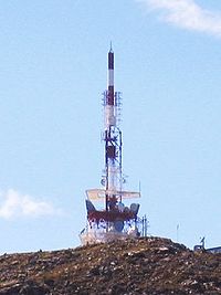 Antenne au sommet