Pangong Tso
- Pangong Tso
-
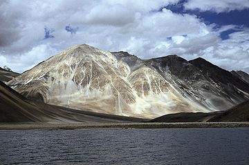
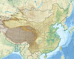
Pangong Tso (སྤང་གོང་མཚོ། ou lac Pangong; Tso (མཚོ་) signifiant lac en ladakhi et en tibétain) est un lac situé dans l'Himalaya, à une altitude d'environ 4250 m. Il est long de 134 km et s'étend entre l'Inde et le Tibet. Les deux tiers de la longueur du lac sont en territoire chinois. Il atteint 5 km en son point le plus large. En hiver, le lac gèle complètement bien que son eau soit salée.
Le Pangong Tso peut être atteint par voiture en 5 h en partant de Leh, par une route de montagne très difficile. La route emprunte le col de Changla situé à 5360m d'altitude. L'accès au lac est ouvert en saison touristique, de mai à septembre.
Un permis spécial est requis pour accéder au lac. Bien qu'un indien puisse obtenir un permis individuel à Leh, les citoyens non-indiens doivent former un groupe d'au moins quatre personnes. Pour des raisons de sécurité, il n'est pas autorisé de naviguer en bateau sur le lac.
Photo
Liens externes
Sur les autres projets Wikimedia :
Notes et références
Wikimedia Foundation.
2010.
Contenu soumis à la licence CC-BY-SA. Source : Article Pangong Tso de Wikipédia en français (auteurs)
Regardez d'autres dictionnaires:
Pangong Tso — Geographische Lage Tibet in China Zuflüsse Kerulen Fluss im Südwesten Orxon Fluss im Osten … Deutsch Wikipedia
Pangong Tso — Lago Pangong (o Pangong Txo) Panorámica del lago Localización geográfica / administrativa … Wikipedia Español
Pangong Tso — Infobox lake lake name = Pangong Tso image lake = Pangong Tso lake.jpg caption lake = image bathymetry = caption bathymetry = location = Ladakh, Jammu and Kashmir, India; Rutog County, Tibet, People s Republic of China coords =… … Wikipedia
Nyak Tso — is a lake in Tibet, China about 30 km from Rudog a town close to India s Ladakh. It is also separated by a small water channel called Aot (?) and a sand shelf from Pangong Tso, which is a 130 km long salt water lake in Ladakh, at 4,249… … Wikipedia
Banggong Co — Pangong Tso Geographische Lage: Tibet in China Zuflüsse: Kerulen Fluss im Südwest … Deutsch Wikipedia
Tsomoriri Wetland Conservation Reserve — Tso Moriri Location Ladakh Coordinates … Wikipedia
Ladakh — region … Wikipedia
Пангонг-Цо — Координаты: Координаты … Википедия
Chang La — Changla Elevation 5,360 m (17,585 ft) … Wikipedia
Geography of Tibet — This article concerns the geography of Historic Tibet, which includes, but is not the same as the present day Tibet Autonomous Region. For the non political geographical region, see Tibetan Plateau. Yamdrok tso. The geography of Tibet consists of … Wikipedia
 Chine,
  Inde
Inde Tibet, Ladakh


