Pacific Heights (San Francisco)

Pacific Heights (San Francisco)

37° 47′ 30″ N 122° 26′ 08″ W / 37.7917, -122.4356

Pacific Heights
The Devil's Backbone
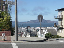
Photographie du quartier.
Pacific Heights
Géographie
Ville San Francisco (San FranciscoCalifornie)
Coordonnées 37° 47′ 30″ N 122° 26′ 08″ W / 37.7917, -122.4356
Quartiers adjacents Lower Pacific Heights
Japantown
Polk Gulch
Presidio Heights
Cow Hollow
Marina District
Superficie 2,5 km2
Démographie
Population 33 115 hab.
Densité 13 246 hab./km²
Administration
Code ZIP 94109, 94115

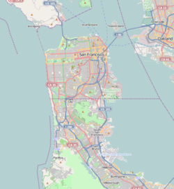
Géolocalisation sur la carte : San Francisco

(Voir situation sur carte : San Francisco)
City locator 4.svg

Géolocalisation sur la carte : Californie

(Voir situation sur carte : Californie)
City locator 4.svg

Géolocalisation sur la carte : États-Unis

(Voir situation sur carte : États-Unis)
City locator 4.svg

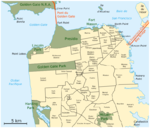
Pacific Heights est un quartier du nord de San Francisco en Californie. Perché sur une colline, il offre des points du vue sur le Golden Gate Bridge, la Baie de San Francisco, Alcatraz et le Presidio. Il s'étend sur 130 blocs entre Presidio Avenue, Van Ness Avenue, California Street et Broadway. Il s'agit d'un quartier résidentiel aisé qui possède deux parcs (Lafayette et Alta Plaza). Sa population était de 33 115 habitants en 2000[1]. On y trouve les consulats de Russie, Grèce, Égypte, Vietnam, Italie et Indonésie. Le plus ancien bâtiment se trouve au 2475 Pacific Avenue et date de 1853. La plupart des boutiques et des restaurants se trouve sur Fillmore Street, au sud de Pacific Avenue. Le principal hôpital est le California Pacific Medical Center. Trois établissements d'enseignement supérieur se trouvent dans le quartier : la Arthur A. Dugoni School of Dentistry, l'Academy of Art University, l'Université de San Francisco USF (Laurel Heights, Lone Mountain)

Sommaire

Habitants célèbres

Actuels

Anciens

Notes et références

Voir aussi

Liens internes

Liens externes

Sur les autres projets Wikimedia :


Wikimedia Foundation. 2010.

Contenu soumis à la licence CC-BY-SA. Source : Article Pacific Heights (San Francisco) de Wikipédia en français (auteurs)

Игры ⚽ Поможем написать курсовую

Regardez d'autres dictionnaires:

  • Pacific Heights (San Francisco) — Vista desde el parque Alta Plaza en el barrio de Pacific Heights de San Francisco, California. Al fondo se distingue Marina District y la Bahía de San Francisco …   Wikipedia Español

  • Pacific Heights (San Francisco) — Pacific Heights ist ein wohlhabendes Stadtviertel von San Francisco. Mit Panoramaaussicht auf die Golden Gate Bridge, die San Francisco Bay, Alcatraz und das Presidio bietet es eine der besten Wohnlagen in der Stadt. Es wird vor allem von young… …   Deutsch Wikipedia

  • Pacific Heights, San Francisco, California — Pacific Heights is an affluent neighborhood of San Francisco, California, on the north side of California Street in the city. Pacific Heights is located in one of the most scenic and park like settings in Northern California, offering panoramic… …   Wikipedia

  • Lower Pacific Heights, San Francisco, California — Lower Pacific Heights, also known as the Upper Fillmore is a neighborhood in San Francisco, California. It is located in the area between Pacific Heights, the Fillmore District, Laurel Heights, and Japantown. The neighborhood is centered on the… …   Wikipedia

  • Bernal Heights, San Francisco — Bernal Heights (San Francisco) Bernal Heights Situation Situation du quartier de Bernal Heights Populat …   Wikipédia en Français

  • Corona Heights, San Francisco — Corona Heights   Neighborhood of San Francisco   Satellite image of the Corona Heights neighborhood. Governmen …   Wikipedia

  • Diamond Heights, San Francisco — Diamond Heights   Neighborhood of San Francisco   Diamond Heights and Glen Canyon Park …   Wikipedia

  • Bernal Heights (San Francisco) — Bernal Heights Bernal, BH, Bernalwood La Bernal Heights hill …   Wikipédia en Français

  • Merced Heights, San Francisco — Merced Heights is a neighborhood in the south western part of the city, west of the Ingleside and Oceanview neighborhoods. It is bordered to the south by Brotherhood Way, to the west by Junipero Serra Boulevard, to the north by Holloway Avenue,… …   Wikipedia

  • Laurel Heights, San Francisco, California — Laurel Heights is a neighborhood to the south of the Presidio and east of the Richmond District. It is bordered by Geary Boulevard or the University of San Francisco campus to the south, Arguello Boulevard to the west, California Street to the… …   Wikipedia

Share the article and excerpts

Direct link
Do a right-click on the link above
and select “Copy Link”