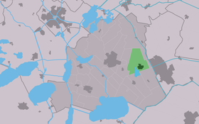
Oudehaske
Contenu soumis à la licence CC-BY-SA. Source : Article Oudehaske de Wikipédia en français (auteurs)
Regardez d'autres dictionnaires:
Oudehaske — Aldehaske Village Country … Wikipedia
Oudehaske — Original name in latin Oudehaske Name in other language Aldehaske, Oldehaske, Oudehaske State code NL Continent/City Europe/Amsterdam longitude 52.95709 latitude 5.87095 altitude 0 Population 1940 Date 2008 10 24 … Cities with a population over 1000 database
Oudehaske — Sp Áudehaskė Ap Oudehaske L Nyderlandai … Pasaulio vietovardžiai. Internetinė duomenų bazė
Oudehaske — Sp Áudehaskė Ap Oudehaske L Olandija … Pasaulio vietovardžiai. Internetinė duomenų bazė
Aldehaske — Oudehaske 52°57′21″N 5°52′20″E / 52.95583, 5.87222 … Wikipédia en Français
Skarsterlân — Infobox Settlement official name = Skarsterlân mapsize = 280px subdivision type = Country subdivision name = Netherlands subdivision type1 = Province subdivision name1 = Friesland area footnotes = (2006) area total km2 = 216.89 area land km2 =… … Wikipedia
List of places in the Netherlands — This is an alphabetical list of places (cities, towns, villages) in the Netherlands. Lists per province can be found at:* List of towns in Groningen * List of towns in Friesland * List of towns in Drente * List of towns in Overijssel * List of… … Wikipedia
A7 motorway (Netherlands) — Location of the A7 motorway in the Netherlands. The A7 motorway is a motorway in the Netherlands connecting Zaandam, via the Afsluitdijk, Sneek and Groningen to the German border near Bad Nieuweschans. The entire road is part of the European… … Wikipedia
Heerenveen — Gemeinde Heerenveen Flagge Wappen Provinz … Deutsch Wikipedia
Joure — Gemeinde Skarsterlân Flagge Wappen Provinz … Deutsch Wikipedia
 Pays-Bas