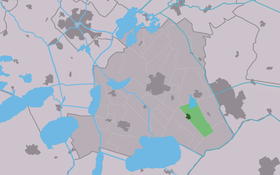
Sintjohannesga
Contenu soumis à la licence CC-BY-SA. Source : Article Sintjohannesga de Wikipédia en français (auteurs)
Regardez d'autres dictionnaires:
Sint Jânsgea — Sintjohannesga 52°55′54″N 5°51′22″E / 52.93167, 5.85611 … Wikipédia en Français
Haskerland — Ancienne commune des Pays Bas Histoire Administration Pays Pays Bas … Wikipédia en Français
Skarsterlân — Infobox Settlement official name = Skarsterlân mapsize = 280px subdivision type = Country subdivision name = Netherlands subdivision type1 = Province subdivision name1 = Friesland area footnotes = (2006) area total km2 = 216.89 area land km2 =… … Wikipedia
List of places in the Netherlands — This is an alphabetical list of places (cities, towns, villages) in the Netherlands. Lists per province can be found at:* List of towns in Groningen * List of towns in Friesland * List of towns in Drente * List of towns in Overijssel * List of… … Wikipedia
Joure — Gemeinde Skarsterlân Flagge Wappen Provinz … Deutsch Wikipedia
Scharsterland — Gemeinde Skarsterlân Flagge Wappen Provinz … Deutsch Wikipedia
Skarsterlân — Gemeinde Skarsterlân Flagge Wappen Provinz Friesland Bürger … Deutsch Wikipedia
Akmarijp — 53°0′17″N 5°47′20″E / 53.00472, 5.78889 … Wikipédia en Français
Alde Ouwer — Oldeouwer 52°55′14″N 5°47′57″E / 52.92056, 5.79917 … Wikipédia en Français
Aldehaske — Oudehaske 52°57′21″N 5°52′20″E / 52.95583, 5.87222 … Wikipédia en Français
 Pays-Bas