Nepricava

Nepricava

Nepričava

Nepričava
Непричава
[[Image:|100px|center|Blason]] [[Image:|100px|center|Drapaeau]]
Héraldique Drapeau

Image Infobox

Latitude
Longitude
44° 21′ 45″ Nord
       20° 06′ 28″ Est
/ 44.3625, 20.1078
 
Pays Serbie Serbie
Partie / Province Serbie centrale
Région
District Kolubara
Municipalité Lajkovac
Code Postal
Altitude 140 m
Superficie
Population (2002) 679 hab.
Densité de population Erreur d’expression : opérateur round inattendu hab/km2
Gentilé
Maire
Mandat en cours

Divers
Site Web [http:// ]
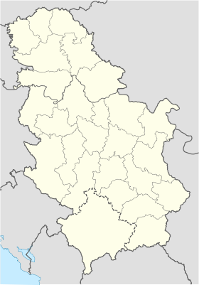
Carte de la Serbie
Nepričava
Municipalité de
Superficie
Population
Densité de population Erreur d’expression : opérateur / inattendu hab/km2
Président
Mandat en cours

Site Web [http:// ]

Nepričava, en serbe cyrillique Непричава, est un village de Serbie situé dans la municipalité de Lajkovac, district de Kolubara. En 2002, il comptait 679 habitants[1], dont 669 Serbes (98,52 %)[2].

Sommaire

Démographie

Évolution démographique
1948 1953 1961 1971 1981 1991 2002
895 917 858 763 763 748 679[1]

Notes et références

  1. a  et b (sr) Livre 9, Population, analyse comparative de la population en 1948, 1953, 1961, 1971, 1981, 1991 et 2002, données par localités, Institut de statistique de la République de Serbie, Belgrade, mai 2004 (ISBN 86-84433-14-9)
  2. (sr) Livre 1, Population, origine nationale ou ethnique, données par localités, Institut de statistique de la République de Serbie, Belgrade, février 2003 (ISBN 86-84433-00-9)

Voir aussi

Articles connexes

Liens externes

  • Portail de la Serbie et du peuple serbe Portail de la Serbie et du peuple serbe
Ce document provient de « Nepri%C4%8Dava ».

Wikimedia Foundation. 2010.

Contenu soumis à la licence CC-BY-SA. Source : Article Nepricava de Wikipédia en français (auteurs)

Игры ⚽ Нужна курсовая?

Regardez d'autres dictionnaires:

  • Nepričava — Непричава Administration Pays  Serbie …   Wikipédia en Français

  • Nepričava — is a village situated in Lajkovac municipality in Serbia.[1] References ^ Institut national d études démographique (INED) Categories: Populated places in SerbiaSerbia geography stubs …   Wikipedia

  • Lajkovac — Лајковац Héraldique …   Wikipédia en Français

  • Lajkovac — Infobox Serbia municipality image shield = native name = Лајковац|official name=Lajkovac district = Kolubara mayor = Vladan Čolović (DS) area km2 = 186 population total = 3443 | mpop=17062 latd = 44| latm = 22|longd = 20| longm = 10 code = 14… …   Wikipedia

  • Banovina of Mačva — Banatus Machoviensis Мачванска бановина Mačvanska banovina Macsói bánság banovina of the Kingdom of Hungary …   Wikipedia

  • List of cities, towns and villages in Serbia — This is the complete list of settlements in Serbia without Kosovo, as recorded by 2002 census, sorted by municipalities. Settlements denoted as urban (towns and cities) are marked bold. Population for every settlement is given in brackets. The… …   Wikipedia

  • List of settlements in Serbia (alphabetic) — This is the complete list of settlements in Serbia without Kosovo, as recorded by 2002 census, in alphabetic order. Settlements denoted as urban (towns and cities) are marked bold. Population for every settlement is given in brackets. The same… …   Wikipedia

  • Bajevac — Бајевац Administration Pays  Serbie …   Wikipédia en Français

  • Bogovada — Bogovađa Bogovađa Боговађа [[Image:|100px|center|Blason]] [[Image:|100px|center|Drapaeau]] Héraldique Drapeau …   Wikipédia en Français

  • Bogovadja — Bogovađa Bogovađa Боговађа [[Image:|100px|center|Blason]] [[Image:|100px|center|Drapaeau]] Héraldique Drapeau …   Wikipédia en Français

Share the article and excerpts

Direct link
Do a right-click on the link above
and select “Copy Link”