Mundesley
- Mundesley
-
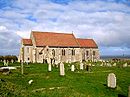
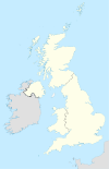
Mundesley est un village du comté de Norfolk en Angleterre. Il se trouve à environ 11.1 kilomètres à l'ouest de Cromer, et à proximité des côtes. Il se trouve à l'embouchure de la Rivière Mun.Il y a 2695 habitants selon le recensement de 2001.
Histoire
Dans le recensement Domesday Book réalisé pour Guillaume le Conquérant en 1086, le village est mentionné sous le nom de Muleslai.
Wikimedia Foundation.
2010.
Contenu soumis à la licence CC-BY-SA. Source : Article Mundesley de Wikipédia en français (auteurs)
Regardez d'autres dictionnaires:
Mundesley — ist eine Ortschaft an der Nordküste der englischen Grafschaft Norfolk ungefähr elf Kilometer östlich von Cromer und ungefähr sechs Kilometer westlich von Bacton. Mundesley ist seit dem 19. Jahrhundert ein touristisch geprägter Ort. Wirtschaft Ab… … Deutsch Wikipedia
Mundesley — Coordinates: 52°52′34″N 1°26′17″E / 52.876°N 1.438°E / 52.876; 1.438 … Wikipedia
Mundesley — Original name in latin Mundesley Name in other language Mundersley State code GB Continent/City Europe/London longitude 52.86219 latitude 1.39552 altitude 42 Population 2755 Date 2010 05 24 … Cities with a population over 1000 database
Mundesley-on-sea — Mundesley ist eine Ortschaft an der Nordküste der englischen Grafschaft Norfolk ungefähr elf Kilometer östlich von Cromer und ungefähr sechs Kilometer westlich von Bacton. Mundesley ist seit dem 19. Jahrhundert ein touristisch geprägter Ort.… … Deutsch Wikipedia
Mundesley-on-Sea railway station — Mundesley on Sea Location Place Mundesley Area North Norfolk … Wikipedia
Mundesley railway station — was a former station on the Norfolk and Suffolk Joint Railway in Mundesley, Norfolk. [British Railways Atlas.1947. p.18] It opened in 1898 [ [http://www.mundesley.org/history.html Mundesley village website ] ] and closed in 1953 when the line… … Wikipedia
Mundesley Lifeboat Station — Coordinates: 52°52′34.6″N 1°26′28.9″E / 52.876278°N 1.441361°E / 52.876278; 1.441361 … Wikipedia
River Mun — The River Mun or Mundesley Beck is a river in the North of the County of Norfolk, England [”OS Explorer Map” 25, Norfolk Coast East, ISBN 0 319 21727 2] . The source of the river can be found in the Parish of Northrepps. The river finally runs… … Wikipedia
Norfolk and Suffolk Joint Railway — GER Coat of arms The Norfolk and Suffolk Joint Railway (NSJR) was a British joint railway company. The NSJR was owned by the Great Eastern Railway (GER) and the Midland and Great Northern Joint Railway (MGNJ) and consisted of two distinct… … Wikipedia
Railway stations in Cromer — The fishing port and holiday resort of Cromer in the English county of Norfolk has had a rail service since 1877. It was served by three railway stations for many years, and is now served by two. Cromer Beach station, which opened in 1887, was… … Wikipedia

 Angleterre
