Antsahampano
- Antsahampano
-
12°19′S 49°11′E / -12.317, 49.183
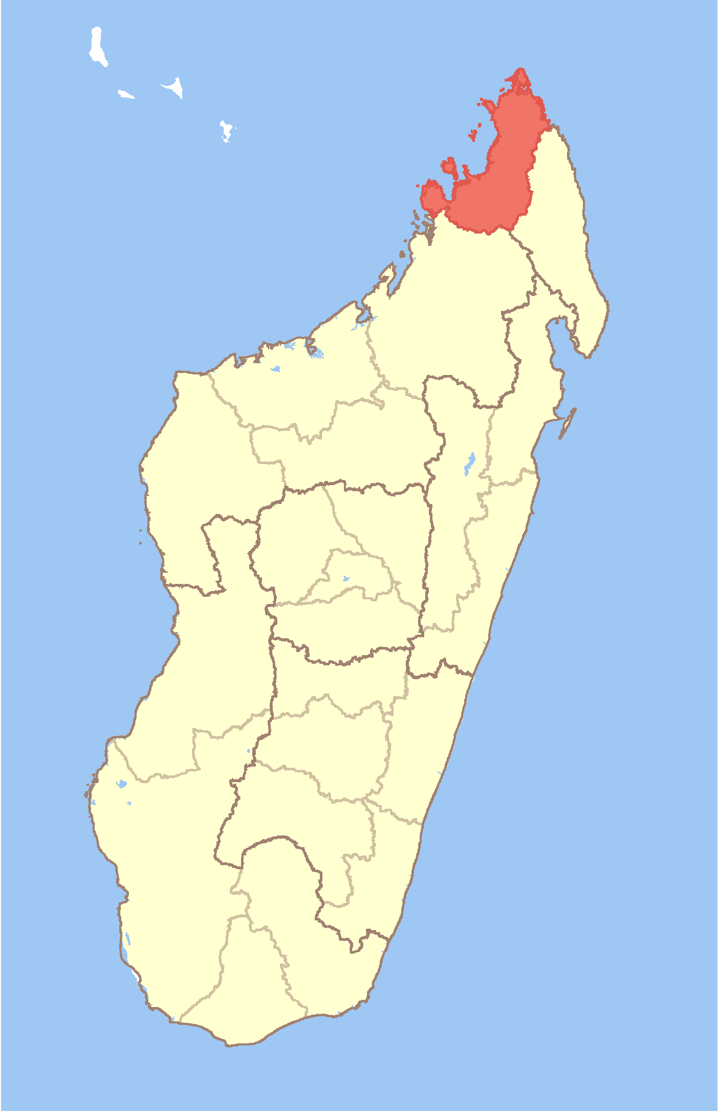
Antsahampano est une ville et une commune urbaine (Kaominina), du nord de Madagascar, dans la province de Diego-Suarez.
Géographie
Cette section est vide, insuffisamment détaillée ou incomplète.
Votre aide est la bienvenue !
Histoire
Cette section est vide, insuffisamment détaillée ou incomplète.
Votre aide est la bienvenue !
Administration
Antsahampano est une commune urbaine du district d'Antsiranana II, située dans la région de Diana, dans la province de Diego-Suarez.
Économie
La population est majoritairement rurale. On trouve sur le territoire communal des exploitations de maïs, d'arachides et de rizières.
Démographie
La population est estimée à 7 624 habitants, en 2001[1].
Notes et références
- ↑ Site Ilo, Université Cornell (2002). 13 février 2008
Voir aussi
Articles connexes
Liens externes
Wikimedia Foundation.
2010.
Contenu soumis à la licence CC-BY-SA. Source : Article Antsahampano de Wikipédia en français (auteurs)
Regardez d'autres dictionnaires:
Antsahampano — Infobox Settlement official name = Antsahampano other name = native name = nickname = settlement type = motto = imagesize = image caption = flag size = image seal size = image shield = shield size = image blank emblem = blank emblem type = blank… … Wikipedia
District d'Antsiranana II — Antsiranana II Région Diana Chef lieu Nombre de kaominina 16 Superficie 6 025 km2 … Wikipédia en Français
Antsiranana — (Malagasy: Antsiran̈ana Malagasy pronunciation: [antsʲˈraŋanə̥]), named Diego Suarez prior to 1975, is a city at the northern tip of Madagascar. Antsiranana is the capital of Diana Region. Contents 1 … Wikipedia
Nosy Be — is situated off the west coast of Diana Region in northern Madagascar … Wikipedia
Diana, Madagascar — Diana is a region in Madagascar. The region is the most northerly part of the island. It borders the adjacent regions of Sava to the east and Sofia to the south. It covers an area of 19,266 km2., and had an estimated population of 485,800 in 2004 … Wikipedia
Mantaly — Mantaly … Wikipedia
Manambato — Manambato … Wikipedia
Mahalina — Mahalina … Wikipedia
Mahavanona — Mahavanona … Wikipedia
Mangaoka — Mangaoka … Wikipedia
 Madagascar